WSI Says New Version Optimizes Pre-Flight Weather Decision
Support
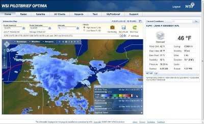
A new, online version of WSI's Pilotbrief service has been
launched by the Weather Service International. The service allows
pilots to quickly receive a "clear and actionable" view of
potential weather impacts and optimize plans accordingly. The
company says the benefits include quicker aircraft turnaround times
and improved mission planning and safety, among others.
The WSI Pilotbrief Optima service's new mapping engine allows
high definition convective weather depiction and enhanced global
overlays. When combined with flight plan and airspace overlays, the
high definition weather information improves route planning and
builds confidence in decision making. The new release
also enables a high level of personalization and 'mid-task'
customization to further streamline pilot workflow.
"The release of WSI Pilotbrief Optima underscores our commitment to
extend WSI's leadership position in global aviation
weather-decision-support by delivering early insight into
disruptive weather conditions, no matter where pilots operate,"
said Mark D. Miller, VP of WSI's Decision Support.
Enhanced Pilotbrief Optima Features:
High Definition (HD) Map - This powerful new mapping engine
combines unrivalled performance, high fidelity and personalization
to take the guess work out of mission planning.
High Definition (HD) Weather Layers - This includes enhanced
Radar, Satellite IR, Vertically Integrated Liquid (VIL) and EchoTop
mosaics. Most notably, the new EchoTop mosaic offers a four-
fold improvement in spatial resolution that clearly shows the
highest tops of greatest concern, improving confidence in route
planning and decision making.
Global Lightning - With an optional overlay to WSI's
proprietary Global Lightning Network (GLN), pilots can quickly
identify areas of strongest convective activity outside
ground-based weather radar range.
SATrad - Derived from satellite imagery and high resolution
model data, WSI's proprietary SATrad provides a synthesized
depiction of convection throughout the tropics. When
combined with global lightning, pilots can pinpoint the areas of
strongest convection to avoid, improving safety and passenger
comfort.
Enhanced Airport and Route Briefings - WSI's proprietary
briefing engine delivers the most relevant weather and NOTAM
information for your mission in a compact, easy to read and highly
transportable briefing package.
Over the next few months, WSI plans to release Pilotbrief Optima
for iPad, a lock-down browser version, and a kiosk version for
FBOs.
Say Altitude Used by ATC to ascertain an aircraft's specific altitude/flight level. When the aircraft is climbing or descending, the pilot should state the indicated altitude round>[...]
Aero Linx: European Air Law Association (EALA) EALA was established in 1988 with the aim to promote the study of European air law and to provide an open forum for those with an int>[...]
From 2023 (YouTube Version): The Life, Death, Life, Death, and Life of a Glorious Warbird In 1981, business-owner Jim Tobul and his father purchased a Chance-Vought F4U Corsair. Mo>[...]
Also: USCG Retires MH-65 Dolphins, Irish Aviation Authority, NATCA Warns FAA, Diamond DA42 AD This summer, history enthusiasts will have a unique opportunity to experience World Wa>[...]
Also: WACO Kitchen Bails, French SportPlane Mfr to FL, Dynon-Advance Flight Systems, Innovation Preview Bobby Bailey, a bit of a fixture in sport aviation circles for his work with>[...]
 ANN's Daily Aero-Term (05.01.24): Say Altitude

