The Right Wing Separated In Flight, At Approximately The Mid-Length Section Of The Right Flap
Location: Watkinsville, GA Accident Number: ERA23FA209
Date & Time: April 26, 2023, 14:25 Local Registration: N123DS
Aircraft: Cessna 177B Injuries: 2 Fatal
Flight Conducted Under: Part 91: General aviation - Personal
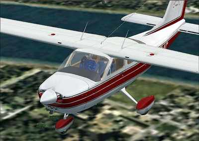
On April 26, 2023, about 1425 eastern daylight time, a Cessna 177B (illustrated below), N123DS, was destroyed when it was involved in an accident near Watkinsville, Georgia. The private pilot and a pilotrated passenger were fatally injured. The airplane was operated as a Title 14 Code of Federal Regulations Part 91 personal flight.
The fight departed Leesburg International Airport (LEE), Leesburg, Florida about 1131 on an instrument flight rules (IFR) flight plan to Barrow County Airport (WDR), Winder, Georgia. Approaching WDR, the pilot established communication with the Atlanta Approach (A80) air traffic controller while descending to 4,000 ft. The controller advised the pilot to inform him when he had the weather and the NOTAMS for WDR and for his approach request. The pilot requested the RNAV Runway 31 approach to WDR. The pilot advised the controller he had the WDR weather. The controller subsequently instructed the pilot to proceed direct to the CADEB waypoint for the RNAV Runway 31 approach. For traffic management, the controller instructed the pilot to fly heading 040° for vectors to the final approach course. The controller then advised him to expect vectors through the final approach course while waiting for another, faster, inbound aircraft to cancel their IFR clearance. The controller then instructed the pilot to
turn right to heading 230°. The airplane was observed on radar descending from 4,000 ft and the low altitude alert activated. The controller issued a safety alert to the pilot and instructed him to maintain 3,000 ft. The pilot read back the altitude. The controller instructed the pilot to fly heading 270°. There were no further transmissions received from N123DS and radar contact was subsequently lost.
Automatic Dependent Surveillance-Broadcast (ADS-B) data provided by the Federal Aviation Administration (FAA) indicated the airplane entered a right turn consistent with the controller’s instructions; however, the airplane remained in the turn until contact was lost. The last ADS-B data point was located about 1,200 ft west of the main wreckage, about 3,000 ft mean sea level.
The main wreckage site was located in an open farm field, about 1.2 miles northwest of Watkinsville. The right wing separated in flight, at approximately the mid-length section of the right flap and came to rest in a wooded area about 988 ft west of the main wreckage. The separated wing section was in close proximity to the coordinates of the last ADS-B data point. The right wing flap also separated in flight and came to rest in the top of a yellow pine tree, approximately 90 ft above the ground, about 428 ft west of the separated right wing section. The ground between the separated right wing and the main wreckage included numerous windshield fragments and lightweight debris.
The initial ground impact area exhibited a left wing leading edge imprint, a crater with the separated and buried propeller blades, three ground scars consistent with the left and right main landing gear wheels and the nose wheel, and an imprint the inboard section of the right wing leading edge. After the initial ground impact, ground scars indicated the highly fragmented wreckage was dispersed on a magnetic heading of approximately 137°. Along the debris path, the engine and the lower section of the cockpit came to rest about 36 ft from the initial ground impact point. The empennage came to rest approximately 22 ft from the engine.
The left wing and the top section of the cockpit came to rest approximately 60 ft from the empennage. The right main landing gear wheel was found approximately 135 ft from the left wing. One of the cabin doors was found approximately 104 ft southwest of the left wing. The engine cowling was found approximately 62 ft northeast of the left wing.
The pilot held an instrument rating and was the owner of the airplane. The pilot-rated passenger, who was his spouse, held a private pilot certificate and did not possess an instrument rating.
The wreckage was retained for further examination.
 Samson Sky Hits the Wind Tunnel