The Airplane Entered A Rapidly Descending And Accelerating Right 360° Spiral
Location: Brownsville, TN Accident Number: ERA21FA189
Date & Time: April 20, 2021, 20:52 Local Registration: N4303G
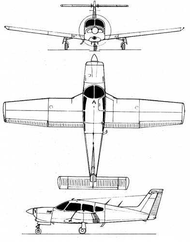
Aircraft: Piper PA-28RT-201T Injuries: 2 Fatal Flight Conducted
Under: Part 91: General aviation - Personal

On April 20, 2021, at 2052 central daylight time, a Piper PA-28RT-201T airplane, N4303G, was destroyed when it was involved in an accident near Brownsville, Tennessee. The student pilot and passenger were fatally injured. The airplane was operated as a personal flight conducted under the provisions of Title 14 Code of Federal Regulations Part 91.
According to the student pilot’s flight instructor, he and the pilot met mid-morning on the day of the accident to discuss a solo cross-country flight from Pearland Regional Airport (LVJ), Houston, Texas to Kyle-Oakley Field Airport (CEY), Murray, Kentucky. The flight instructor reported that the pilot told him the purpose of the trip was to visit a family member that had recently been admitted to the hospital. The flight instructor stated that “it was supposed to be a daytime flight” and he expected the pilot to depart no later than 1300 or 1400, due to the weather coming in later in the day and nighttime conditions.
Review of preliminary flight track and Automatic Dependent Surveillance – Broadcast (ADS-B) data found that the student pilot departed LVJ at 1720, proceeded southbound for a few minutes, and then headed northeast. After leaving the Houston metro area, the enroute course showed few deviations for a track consistent with a direct route of flight to CEY.
At 2051:20, the airplane’s altitude was about 7,300 ft mean sea level (msl), the course turned to the right which was eastbound, and groundspeed was 165 knots. For the subsequent 30 seconds the course continued eastbound, and altitude and groundspeed remained generally constant. At 2052:17, the airplane’s heading had continued the right turn and was headed south, altitude had descended to about 6,700 ft msl, and groundspeed slowed by 20 knots.
Subsequently, the airplane entered a rapidly descending and accelerating right 360° spiral. In the spiral, groundspeed reached a maximum of 247 knots. At 2052:47, the final data point was recorded about 1/4 mile northeast of the accident site which showed the airplane headed south, at 1,450 ft msl and 224 knots groundspeed.
Review of preliminary air traffic control communications provided by the Federal Aviation Administration (FAA) revealed that in the final minutes of the flight the pilot was communicating with Memphis Air Route Traffic Control Center. About 2 minutes and 30 seconds prior to radar contact being lost, the pilot radioed to Memphis Center stating that he was flying at 7,500 ft mean sea level (msl), his final destination was CEY, and added that he was planning to “start my descent now” for his final approach and he was going to make it a “gradual descent.” The controller responded by providing the CEY altimeter setting and advised the pilot of moderate precipitation “starting now lasting all the way to the [destination] airport.” The controller further stated in part that “everything between now and [CEY] is on the verge of being [instrument meteorological] conditions, it looks likes ceilings are down to about 1,500 ft most everywhere.”
The pilot responded, “ok affirmative I’m gonna still descend down” to “2,000-3,000 ft”. He further added that he was looking at a screen for weather and he would begin his final descent once he was within 10 miles of CEY. The controller responded by advising the pilot to maintain visual flight rules and then provided additional weather observation reports for airports along the pilot’s route of flight that were reporting instrument meteorological conditions. The controller advised that a course to the east may help him remain clear of the weather. The pilot acknowledged the controller. About 50 seconds later a “mayday” call was announced over the radio. There was no call sign associated with the distress call, nor any further information given with the call. The controller attempted to reach the pilot several times after the mayday call, however, no further communications were received.
The FAA issued a missing aircraft alert shortly after radar contact was lost. Local authorities discovered the wreckage about 0730 the next morning.
According to FAA airman records, the pilot held a student pilot certificate. He was issued a third-class medical certificate on January 14, 2019. The flight instructor estimated the student pilot had about 90 flight hours of experience. He added that the student pilot had a solo crosscountry route endorsement for the flight and an endorsement to solo the accident airplane. According to FAA airworthiness records, the 4-seat, single-engine, low-wing airplane was manufactured in 1983. It was powered by a Continental TSIO-360-FB 201-horsepower engine. According to the FAA registration records, the student pilot purchased the airplane in July 2019.
The main wreckage was located partially submerged in a creek and along a muddy ravine in a forest. All major components of the airplane were located within about a 100-ft-long debris path, and the wreckage was heavily fragmented. There was no evidence of a postimpact fire. Flight control cable continuity could not be established from the flight control surfaces to the cockpit due to the heavy fragmentation of the wreckage. The control cables that were observed displayed fracture features that were consistent with separation due to overload.
The main and nose landing gear were found in the debris. The left main landing gear actuator was consistent with an up position. The right and nose main landing gear actuators were not located. The flap control cable remained attached to the flap; however, a flap position could not be determined due to the impact damage. The fuel selector valve had separated from the airframe and was selected to the right fuel tank valve.
The cockpit and instrument panel were heavily fragmented. The standby attitude indicator was found in the debris. When disassembled, the gyro remained intact, and its housing exhibited rotational scoring. No other flight instruments, including the primary flight display, were observed or readable.
The engine was found co-located with the main wreckage mostly submerged in water and thick mud. The engine displayed significant impact damage and the crankshaft could not be rotated due to the damage. Each cylinder, with the exception of the No. 5 cylinder, showed that the valves remained intact and were unremarkable. The No. 5 cylinder sustained significant impact damage. The forward valve was impact damaged and was found loose in the cylinder and its spring had separated. All top sparkplugs displayed normal combustion signatures, with exception to the No. 5 cylinder sparkplug, which was impact damaged and could not be removed.
The fuel manifold was found partially attached to the engine; when disassembled fuel was observed in the unit and the screen was clean, with exception of a small glob of mud that was consistent with the mud observed on the outer casing of the unit. The rear and bottom portions of the crankcase were fractured allowing an unobstructive view of the engine’s drive gears, which all appeared unremarkable.
The propeller flange and propeller hub had separated from the engine and were located within a few feet of the main wreckage. Partial s-bending, leading edge gouges, and chord wise scratches were observed on the propeller.
The 2055 recorded weather observation at Covington Municipal Airport (M04), Covington, Tennessee, located about 10 miles west of the accident site, included an overcast ceiling at 1,200 ft above ground level, visibility 5 statute miles, mist, wind 350° at 18 knots. The temperature was 5° C, and the dew point was 4° C.
Preliminary review of radar and satellite data indicated that precipitation and cloud cover was located near the accident site. According to Leidos Flight Service and Foreflight, there was no record that the pilot filed a flight plan or requested an official weather briefing via telephone or online.
The wreckage was retained for further examination.
 ANN's Daily Aero-Term (04.26.24): DETRESFA (Distress Phrase)

