Mon, May 01, 2017
Intended To Streamline The Commercial Drone Authorization Process
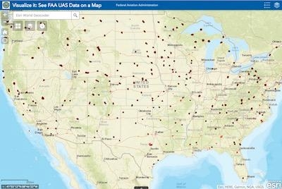
The FAA has published more than 200 facility maps to streamline the commercial drone authorization process. The maps depict areas and altitudes near airports where UAS may operate safely. But drone operators still need FAA authorization to fly in those areas.
This marks a key first step as the FAA and industry work together to automate the airspace authorization process. The maps will help drone operators improve the quality of their Part 107 airspace authorization requests and help the FAA process the requests more quickly. The maps are informational and do not give people permission to fly drones. Remote pilots must still submit an online airspace authorization application.
Operators may download the map data in several formats, view the site on mobile devices and customize their views. The map viewer displays numbers in grid cells which represent the distances Above Ground Level (AGL) in one square mile up to 400 feet where drones may fly. Zeros indicate critical locations around airports and other aircraft operating areas, like hospital helipads, where no drone flights can be preauthorized. Requests to operate in these areas will require further coordination and FAA safety analysis, which can result in additional safety mitigations to be complied with by the drone operator. Remote pilots can refer to the maps to tailor their requests to align with locations and altitudes when they complete airspace authorization applications. This will help simplify the process and increase the likelihood that the FAA will approve their requests.
FAA air traffic personnel will use the maps to process Part 107 airspace authorization requests. Altitudes that exceed those depicted on the maps require additional safety analysis and coordination to determine if an application can be approved.
Additional maps will be published every 56 days through the end of the year. The updates will coincide with the agency’s existing 56-day aeronautical chart production schedule (PDF). If a map is not yet available, it can be expected in future releases.
The facility maps are an important accomplishment as the FAA collaborates with industry to safely integrate drones into the National Airspace System. They will help improve the safety of drone and traditional aircraft operations. Questions may be directed to the FAA's UAS Integration Office via uashelp@faa.gov or by calling 844-FLY-MY-UA.
(Source: FAA news release)
More News
"Fly-by-wire flight, coupled with additional capability that are being integrated into ALFA, provide a great foundation for Bell to expand on its autonomous capabilities. This airc>[...]
Hold Procedure A predetermined maneuver which keeps aircraft within a specified airspace while awaiting further clearance from air traffic control. Also used during ground operatio>[...]
Aero Linx: B-21 Raider The B-21 Raider will be a dual-capable penetrating strike stealth bomber capable of delivering both conventional and nuclear munitions. The B-21 will form th>[...]
Also: Virgin Galactic, B-29 Doc to Allentown, Erickson Fire-Fighters Bought, FAA Reauthorization After dealing with a big letdown after the unexpected decision by Skyreach to disco>[...]
Also: Skydio Chief, Uncle Sam Sues, Dash 7 magniX, OR UAS Accelerator US Secretary of the Air Force Frank Kendall was given a turn around the patch in the 'X-62A Variable In-flight>[...]
 Aero-News: Quote of the Day (05.09.24)

