Ball On Cusp Of Providing New Space LiDAR For The Next Generation Of Global Weather Prediction And Climate Analysis
Ten years ago this week the first images were returned from the CALIPSO and CloudSat atmospheric aerosol LIDAR (Light Detection And Ranging) and cloud-profiling radar missions following their joint launch on April 28, 2006. The satellites joined the A-Train, a coordinated group of international satellites providing simultaneous observation data used by scientists to advance knowledge of Earth-system science.
"Ball Aerospace is proud to have provided innovative technologies for both of these global science missions," said Jim Oschmann, vice president and general manager for Ball's Civil Space business unit. "Ensuring mission success and good value for programs that last far beyond their design life is how we help our customers achieve their missions."
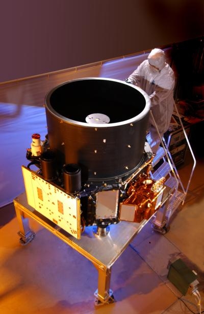
Since launching,CALIPSO has traveled more than 1.6 billion miles, and has fired its laser over 5.8 billion times and is still going strong. The satellite has produced more than 90 terabytes of data, and orbited the Earth 43,000 times to study how clouds and aerosols impact the Earth's climate. Ball built CALIPSO's LiDAR and wide-field camera instruments, data processing and communications equipment, and integrated the instrumentation suite. CALIPSO is a research partnership between NASA's Langley Research Center in Hampton, Virginia and the Centre National d'Etudes Spatiales' (CNES). Originally designed for a life of three years, scientists continue using data from CALIPSO to construct 3-D models of the atmosphere that improve our ability to predict future climate change.
CloudSat launched with capabilities 1,000 times more sensitive than typical weather radar. Ball Aerospace built the CloudSat spacecraft and tested and integrated the Cloud Profiling Radar payload, built by NASA's Jet Propulsion Laboratory. CloudSat uses millimeter-wavelength radar to measure the altitude and properties of clouds to provide scientists never-before-seen 3-D perspectives of Earth's clouds that answer questions about how they form, evolve and affect our weather, climate and freshwater supply. After surpassing its two-year design life, CloudSat's aging batteries began to lose power in April 2011. Ball resolved the problem with creative operations allowing the spacecraft to collect data in daylight. For its mission-saving efforts, Ball's CloudSat team won a NASA Exceptional Public Achievement Award.
CloudSat and CALIPSO launched into a 438-mile circular sun-synchronous polar orbit, to fly in orbital formation as part of the A-Train constellation of other Earth Observing satellites including Aqua, Aura, OCO-2 and Centre National d'Etudes Spatiales' (CNES) PARASOL. CALIPSO and CloudSat are highly complementary programs; the LiDAR provides the highest resolution data and the Radar provides data into dense clouds that the LiDAR can't penetrate.
Ball's advanced development of LiDAR measurements from space currently includes new work for NASA's ATHENA OAWL project to provide 3-D wind profiles to improve understanding of weather, water and energy cycles.
(Image provided with Ball Aerospace news release)
 ANN's Daily Aero-Term (04.25.24): Airport Rotating Beacon

