We've been sitting on this secret for several weeks now and
FINALLY, we get to let the feline out of the paper sack... Garmin
has upped the ante in the ongoing portable GPS/Map wars. They call
it the GPSMAP 696.
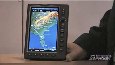
The GPSMAP 696 is an all new, tablet-style device with a large,
7-inch portrait screen that makes it possible to view an entire
approach plate on the display. The high-resolution, sunlight
readable screen uses Garmin's latest technology to ensure that
pilots will be able to read the vibrant display day or night. The
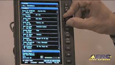
bezel that frames the bright screen has multiple keys on the bottom
and right sides. The soft keys at the bottom of the display control
the most commonly used features of the current page, such as
turning the weather display on/off. The dedicated keys on the
display's right side have specific functions such as nearest,
direct to, flight plan, zoom in/out and menu. Also on the display's
right side is a rotary knob/joystick, similar to the G1000's
joystick, that lets pilots enter airport identifiers, pan the map,
or scroll to page and sub-page groups.
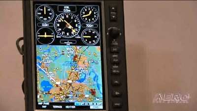
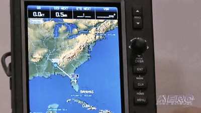
The GPSMAP 696's IFR map mode displays a map similar to a
standard enroute chart that has important features like victor
airways, jet routes, minimum enroute altitude (MEA) and leg
distance. The 696's IFR map mode also offers more situational
awareness than traditional charts because it subtlety displays
major visual reference points like rivers, state boundaries,
highways and railroad tracks from Garmin's built-in basemap.
The GPSMAP 696 also includes Garmin FliteCharts, an electronic
version of the National Aeronautical Chart Office (NACO) U.S.
Terminal Procedures Publication. With FliteCharts, pilots can
quickly find and view all NACO departure procedures (DP), standard
terminal arrival routes (STARs), approach charts and airport
diagrams. If the current approach is known, the GPSMAP 696
automatically selects the correct chart based on the flight plan.
FliteCharts are available every 28-days and will not be available
on the 696 if they are not updated regularly. The GPSMAP 696 may be
used in lieu of paper approach charts when used in accordance with
AC 90-78.
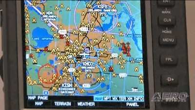
Garmin notes that other popular features found on the GPSMAP 696
include Smart Airspace, SafeTaxi and AOPA Airport Directory data.
During flight, Garmin's Smart Airspace automatically highlights
airspace close to the pilot's current altitude and de-emphasizes
airspace away from the current altitude, which ultimately aids in
situational awareness. With SafeTaxi, taxiing at unfamiliar
airports is also easier because the GPSMAP 696 includes
geo-referenced diagrams of over 850 U.S. airports that identify
runways, taxiways and hangars, as well as the aircraft's exact
location on the field.
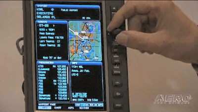
The AOPA Airport Directory data is an electronic version of
AOPA's popular U.S. pilot guide that includes information for over
5,300 public-use airports and more than 7,000 FBOs, such as pilot
services, ground transportation, lodging, restaurants, and local
attractions. In addition, Garmin's electronic version of the AOPA
Airport Directory highlights airports where pilots can save on fuel
by using self-service fueling locations.

The GPSMAP 695 and 696 are available immediately for an expected
street price of $2,695 and $3,295, respectively. The GPSMAP 696
package includes a yoke mount, GXM 40 smart antenna,
cigarette-lighter adapter, AC adapter cable, USB-to-PC interface
cable, low-profile remote GPS antenna, unit cover, free Jeppesen
update certificate, owner's manual and quick-reference
guide.
 ANN's Daily Aero-Term (04.30.24): Runway Centerline Lighting

