Sun, Aug 17, 2008
Fatal Accident Occurred As A/C Went Down At A "Steep
Angle"
 Scud running... it's the bane of many a VFR flyer who can't or
won't file IFR or stay on the ground when the conditions tend to
start the bird walking. It appears that another pilot has fallen to
this hazard... and we can only hope (forlornly, we'd imagine) that
he might be the last.
Scud running... it's the bane of many a VFR flyer who can't or
won't file IFR or stay on the ground when the conditions tend to
start the bird walking. It appears that another pilot has fallen to
this hazard... and we can only hope (forlornly, we'd imagine) that
he might be the last.
NTSB Identification: DEN08LA139
14 CFR Part 91: General Aviation
Accident occurred Monday, August 11, 2008 in Muskogee, OK
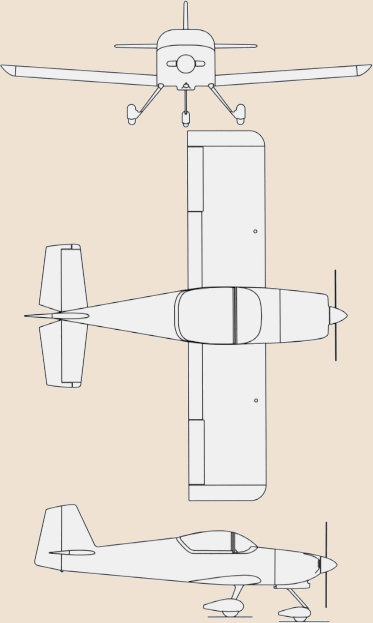
Aircraft: Dickey RV-6A, registration: N22163
Injuries: 1 Fatal.
This is preliminary information, subject to change, and may
contain errors. Any errors in this report will be corrected when
the final report has been completed.
On August 11, 2008, about 1325 central daylight time (CDT), a
Dickey RV-6A experimental airplane, N22163 impacted terrain
following a loss of control while conducting a cross-country
flight. The instrument-rated private pilot was fatally injured. The
airplane was destroyed. The personal flight was being conducted
under the provisions of Title 14 Code of Federal Regulations Part
91 without a flight plan. Instrument meteorological conditions
prevailed at the time of the accident. The flight originated at
Fayette County Airport, Tennessee (FYE) with an intended
destination of Borger, Texas (BGD).
Witnesses indicate the engine was running at the time of impact.
Law enforcement officials stated the weather at the time of the
accident was cloudy and misty with visibility less than 1 ½
mile. Weather at Davis Field Airport, Oklahoma (MKO) at 1353 CDT
was overcast skies at 1,100 feet, light rain and 10 miles
visibility.
A examination of the airplane and the accident site indicated
the airplane impacted the ground at a steep angle. The engine and
forward fuselage were buried in an impact crater approximately four
feet deep with the engine resting at approximately 80 degrees.
Airplane wreckage was mostly confined to the point of impact with
some pieces spread across an area approximately 90 feet long by 50
feet wide on a southeasterly heading.
More News
Airport Marking Aids Markings used on runway and taxiway surfaces to identify a specific runway, a runway threshold, a centerline, a hold line, etc. A runway should be marked in ac>[...]
"It is extremely difficult, if not impossible, for manned aircraft to see a drone while conducting crop-enhancing and other aerial applications at low altitudes and high speeds. We>[...]
Aero Linx: The Skyhawk Association The Skyhawk Association is a non-profit organization founded by former Skyhawk Pilots which is open to anyone with an affinity for the A-4 Skyhaw>[...]
“The T-54A benefits from an active Beechcraft King Air assembly line in Wichita, Kansas, where all required METS avionics and interior modifications are installed on the line>[...]
Aero Linx: Aerostar Owners Association The Association offers the Aerostar Owner a unique opportunity to tap an invaluable source of information concerning the care and feeding of >[...]
 ANN's Daily Aero-Term (04.28.24): Airport Marking Aids

