Mon, Jan 13, 2014
Supported Operations Following Typhoon Haiyan
The inherent intelligence, surveillance and reconnaissance (ISR) capabilities of the Global Hawk Block 30 Unmanned Aerial System were used to support massive international humanitarian assistance and relief efforts following Typhoon Haiyan in the Philippines. Manufacturer Northrop Gurmman says that, due to Global Hawk's long endurance, persistence and range, the aircraft was "the only high altitude asset able to support relief efforts in this critical region of the world on a moment's notice. Global Hawk is also the only high altitude unmanned system able to carry radar, electro-optical (EO) and infrared sensors simultaneously."
On Nov. 14, Global Hawk flew its first of three critical sorties from Guam to the Philippines. It collected 282 wide-area images of the typhoon- ravaged area before returning to Andersen Air Force Base. Rapidly collected EO imagery was quickly relayed to U.S. and Philippine authorities to assist with infrastructure and damage assessments. Imagery also aided in logistical assessments of roads, airports and fields to help relief teams swiftly reach displaced survivors. On Nov. 16 and 20, the U.S. Air Force added the second and third sorties to support relief efforts.
In total, Global Hawk collected approximately 1,000 planned images and a number of ad hoc collections on each sortie. Global Hawk's system flexibility allows for ad hoc retasking to obtain specific pertinent imagery and data. "Mission planning in a crisis is hard, but having the ability to task and retask Global Hawk gives commanders the flexibility to conduct productive ISR missions that feed near real-time information to the response teams who need it the most," said Jim Culmo, Northrop Grumman's vice president, High Altitude Long Endurance Enterprise, Northrop Grumman.
When disaster strikes, understanding the magnitude of destruction left in the wake of the event is critical. NGC says Global Hawk's EO imagery covers large regions with high-resolution detail in support of vital life-saving operations.
Global Hawk's first humanitarian mission took place in 2007, as Southern California fought major fires. In 2010, Global Hawk supported international requests for surveillance following the Haiti earthquake. Similarly, the Global Hawk collected data and imagery within the dangerous radiation zones over the Fukushima power plant following Japan's 2011 earthquake and tsunami disaster.
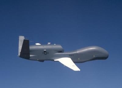
(Global Hawk image from file)
More News
With Testing Soon Complete, Launch Preparations Begin in Earnest Sierra Space's Dream Chaser has been put through the wringer at NASA's Glenn Armstrong Test Facility in Ohio, but w>[...]
Takeoff Roll The process whereby an aircraft is aligned with the runway centerline and the aircraft is moving with the intent to take off. For helicopters, this pertains to the act>[...]
“We’re proud of the hard work that went into receiving this validation, and it will be a welcome relief to our customers in the European Union. We couldn’t be mor>[...]
"Aircraft Spruce is pleased to announce the acquisition of the parts distribution operations of Wag-Aero. Wag-Aero was founded in the 1960’s by Dick and Bobbie Wagner in the >[...]
IDENT Feature The special feature in the Air Traffic Control Radar Beacon System (ATCRBS) equipment. It is used to immediately distinguish one displayed beacon target from other be>[...]
 Sierra Space Repositions Dream Chaser for First Mission

