Pilot Fatally Injured When Aircraft Impacted Mountainous Terrain
The NTSB has released its preliminary report from an accident in Alaska involving a Pilatus Porter PC-6 that went down October 28th.
According to the report, the turbine-powered tailwheel-equipped aircraft sustained substantial damage after impacting mountainous terrain about 57 miles north-northeast of Port Alsworth, Alaska, in the Neacola Mountains of Lake Clark National Park and Preserve. The airplane was being operated as a visual flight rules (VFR) cross-country personal flight under the provisions of Title 14 Code of Federal Regulations (CFR) Part 91. The commercial rated pilot, the sole occupant, sustained fatal injuries. Visual meteorological conditions prevailed at the departure and destination, with areas of reduced visibility and lower cloud ceilings along the route of flight. No flight plan had been filed.
The flight departed Lake Hood Seaplane Base, Anchorage, Alaska, at 1711, destined for a private airstrip near Port Alsworth. During a phone conversation with the National Transportation Safety Board (NTSB) investigator-in-charge (IIC) on October 31, a family member said that the purpose of the flight was a fuel delivery to a family homestead near Lake Clark, just as the pilot had done the previous day. According to friends and family, the pilot was very familiar with the routes through the mountains to Lake Clark, and he had the airplane outfitted with an internal 250- gallon fuel tank. Typically, the pilot would fly through the Lake Clark Pass unless the weather was low, in which case he would take the northern Merrill Pass route.

According to a family member in Port Alsworth, the pilot requested the weather conditions at Lake Clark prior to departure, which were reported as windy with a high overcast cloud layer and "no blue sky". A preliminary review of Federal Aviation Administration (FAA) radar data revealed that after departure the airplane turned west after reaching the northwest side of Cook Inlet and prior to reaching the Lake Clark Pass entry. According to a text message provided by a friend of the pilot, the pilot communicated that the pass "looks fuzzy" and "on my way, holes out west" while flying en route prior to crossing the mountains. The airplane then climbed up to an altitude of about 14,600 feet on the east side of the mountains, and descended westward down to 7,700 feet near the accident site. The last radar return at 1827 indicates a ground speed of 119 knots, a rate of descent of about 833 feet per minute and a heading of about 340 degrees.
According to Air Force Rescue Coordination Center (RCC), an Emergency Locator Transmitter (ELT) signal was received about 1831 with partial position information from an ELT that was registered to N5308F. A more accurate position was obtained by the RCC about 1922. About 2252, the RCC coordinated a search of the area by helicopter; however, low visibility and darkness prevented search area access. The FAA issued an alert notice at 2253. The RCC coordinated daily search flights with an HH-60 helicopter and HC-130 airplane from October 29 through November 3. The 406 MHz signal stopped transmitting late on October 30. Low ceilings and visibility prevented a search of the immediate ELT area for 5 days.
On November 4, the Civil Air Patrol joined the search due to a forecast for improved weather. The ELT 121.5 MHz VHF signal was still transmitting a continuous signal and was used by the search crews to locate the wreckage on the morning of November 4. The pilot's remains were recovered from the scene by RCC rescue personnel. The remote accident site consists of steep, mountainous, snow-covered terrain oriented north and south within the Alaska Range with a peak of about 8,336 feet in the near vicinity. The wreckage is located about 6 miles south of Merrill Pass west and 14 miles northeast of Lake Telaquana within the Lake Clark National Park and Preserve. The airplane wreckage is located about 6,500 feet on the south side of a ridge line, heading north. Search crews reported substantial damage to the forward portion of the fuselage and nose.
At 1755, an aviation routine weather report (METAR) from Sparrevohn LRRS Airport (the closest weather reporting facility) reported, in part: wind 140 degrees at 20 knots, gusts to 41 knots; visibility 10 statute miles; sky condition, overcast at 8,500 feet; temperature 48 degrees F, dew point 34 degrees F; altimeter 29.57 inHg. The FAA Aviation Weather Camera images on October 28 from Lake Clark Pass East show weather diminishing at about 1547 ADT to below 1 statue mile, and images from Merrill Pass High and Low Weather Cameras indicating diminishing visibility at 1624 to at or below 1 statute mile visibility in snow with mountains obscured. Official sunset for October 28, 2016, was 1815 with civil twilight ending at 1901 ADT.
A detailed wreckage and engine examination is pending. The airplane was equipped with a Aireasearch Garrett Honeywell TPE 331 turbine engine. A Garmin 496 GPS was recovered from the scene and sent to the NTSB Vehicle Recorder Laboratory in Washington, D.C., for download.
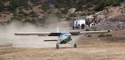
(Image from file. Not accident airplane)
 ANN's Daily Aero-Term (05.07.24): Hazardous Weather Information

