Faster, Sharper
 AOPA has improved its online
instrument approach chart service available free to all
members.
AOPA has improved its online
instrument approach chart service available free to all
members.
"Our online instrument charts have been hugely popular with our
members since first introduced in 2001," said AOPA President Phil
Boyer. "Now they're even better — crisper and faster to
download."
For more than three years, AOPA members have enjoyed electronic
access to instrument approach procedures (IAPs) through AOPA's
Airport Directory Online. Now the association is able to offer
higher resolution charts while decreasing the file size — and
that decreases the download time.
These instrument approaches and terminal procedures charts
— published by FAA's National Aeronautical Charting Office
(NACO) — are legal for navigation and free to AOPA members.
They can be viewed, downloaded, and printed.
NACO now offers the charts in a digital format with much greater
resolution than the scanned charts previously on AOPA Online. But
with greater resolution comes much greater file size. However, in
order to decrease download times for members, AOPA is dramatically
reducing file sizes using a process that only minimally affects
resolution.
"These enhancements mean that members will have even more
powerful flight planning tools at their fingertips using a new
generation of approach charts — sharp in detail, yet very
small in file size — accessible directly from AOPA's Airport
Directory Online and AOPA's Real-Time Flight Planner," said
Boyer.
In a simple flight planning session, AOPA members can plot a
route, check for temporary flight restrictions, obtain weather, and
file a flight plan. With just a few additional clicks, they can
also download kneeboard-sized airport directory data and the new
instrument approach charts.
The digital processing reduces file size by as much as 80
percent from the original NACO digital files — for a fast
download, even with slower dial-up Internet connections.
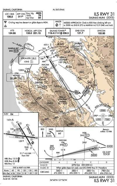
For example, the original NACO approach charts for Salinas,
California, are well over 1 MB, yet the reduced versions of the
same charts are less than 200 KB. One major image improvement
members will notice immediately is the crisp sharp detail of the
new digitally produced charts — some with color depiction of
high terrain contours thanks to NACO's initiative to provide
essential safety features for approaches situated near rising or
high terrain.
A full chart set of more than 13,000 procedures will be posted
every 28 days, with AOPA's Airport Directory Online following the
government aeronautical charting schedule.
"To help AOPA members identify charts that have changed since
the previous 28-day period, there will be an indication next to the
chart's download link that shows whether it was added, deleted, or
changed during that time frame," said Machteld Smith, director of
AOPA's Airport Directory. "This same information will also be
available in each member's personal 'My Procedures' area, where
AOPA members can store links to all of the procedures for their
favorite airports and from where they can access these procedures
to batch-download multiple charts to their personal computer."
Other planned enhancements include a history lookup in "My
Procedures" so users can determine when a procedure has
changed.
"Unlike the printed charts, NACO currently does not provide the
effective date on the digital charts," said Smith. "But by checking
the chart's history of changes, one can determine if a chart
previously printed was changed during subsequent update cycles.
While it is always incumbent upon the user to find out if the chart
is current or has changed, AOPA felt it would be beneficial to
provide chart history in 'My Procedures' to help with this process.
AOPA will also assist members in understanding how to interpret the
official amendment date printed on each chart."
With the launch of the new charts on June 10, AOPA will for the
first time include military airports and their associated
instrument procedures in AOPA's Airport Directory Online. This
information can be invaluable in emergency situations. And pilots
may make practice instrument approaches (without landing) at
military fields with proper permission from air traffic
control.
AOPA reminds pilots that it is the pilot's responsibility to use
current charts and to make sure that all charts necessary for a
flight are available during that flight; AOPA does not advocate
flying on instruments without the approach procedures for the
entire route on board. The online charts are also a perfect
complement to a full chart service for student training, instrument
proficiency flights, and trips slightly outside a region of chart
subscription coverage.
 Airborne 05.10.24: Icon Auction, Drunk MedEvac Pilot, Bell ALFA

