Hurricane Michael: FAA Information For Drone Operators | Aero-News Network
Aero-News Network
RSS icon RSS feed
podcast icon MP3 podcast
Subscribe Aero-News e-mail Newsletter Subscribe

Airborne Unlimited -- Most Recent Daily Episodes

Episode Date

Airborne-Monday

Airborne-Tuesday

Airborne-Wednesday Airborne-Thursday

Airborne-Friday

Airborne On YouTube

Airborne-Unlimited-05.13.24

Airborne-NextGen-05.07.24

Airborne-Unlimited-05.08.24 Airborne-FlightTraining-05.09.24

Airborne-Unlimited-05.10.24

Thu, Oct 11, 2018

Hurricane Michael: FAA Information For Drone Operators

Fines For Flying In Restricted Areas May Exceed $20,000

The FAA is warning drone owners and operators that they will be subject to significant fines that may exceed $20,000 if they interfere with emergency response operations in the areas affected by Hurricane Michael.

Many aircraft that are conducting life-saving missions and other critical response and recovery efforts are likely to be flying at low altitudes over areas affected by the storm. Flying a drone without authorization in or near the disaster area may unintentionally disrupt rescue operations and violate federal, state, or local laws and ordinances, even if a Temporary Flight Restriction (TFR) is not in place. Allow first responders to save lives and property without interference.

Government agencies with an FAA Certificate of Authorization (COA) or flying under Part 107, as well as private sector Part 107 drone operators who want to support response and recovery operations, are strongly encouraged to coordinate their activities with the local incident commander responsible for the area in which they want to operate.

If drone operators need to fly in controlled airspace or a disaster TFR to support the response and recovery, operators must contact the FAA’s System Operations Support Center (SOSC) by emailing 9-ATOR-HQ-SOSC@faa.gov the information they need to authorize access to the airspace. Coordination with the SOSC may also include a requirement that a drone operator obtain support from the appropriate incident commander.

Here’s the information the FAA may require:

  • the unmanned aircraft type
  • a PDF copy of a current FAA COA
  • the pilot’s Part 107 certificate number
  • details about the proposed flight (date, time, location, altitude, direction and distance to the nearest airport, and latitude/longitude)
  • nature of the event (fire, law enforcement, local/national disaster, missing person) and the pilot’s qualification information.

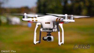
(Source: FAA news release. Image from file)

FMI: www.faa.gov

Advertisement

More News

Bolen Gives Congress a Rare Thumbs-Up

Aviation Governance Secured...At Least For a While The National Business Aviation Association similarly applauded the passage of the FAA's recent reauthorization, contentedly recou>[...]

The SportPlane Resource Guide RETURNS!!!!

Emphasis On Growing The Future of Aviation Through Concentration on 'AFFORDABLE FLYERS' It's been a number of years since the Latest Edition of Jim Campbell's HUGE SportPlane Resou>[...]

Buying Sprees Continue: Textron eAviation Takes On Amazilia Aerospace

Amazilia Aerospace GmbH, Develops Digital Flight Control, Flight Guidance And Vehicle Management Systems Textron eAviation has acquired substantially all the assets of Amazilia Aer>[...]

Hawker 4000 Bizjets Gain Nav System, Data Link STC

Honeywell's Primus Brings New Tools and Niceties for Hawker Operators Hawker 4000 business jet operators have a new installation on the table, now that the FAA has granted an STC f>[...]

Echodyne Gets BVLOS Waiver for AiRanger Aircraft

Company Celebrates Niche-but-Important Advancement in Industry Standards Echodyne has announced full integration of its proprietary 'EchoFlight' radar into the e American Aerospace>[...]

blog comments powered by Disqus


Advertisement

Advertisement

Podcasts

Advertisement

© 2007 - 2024 Web Development & Design by Pauli Systems, LC