Wed, May 04, 2011
WSI Says New Version Optimizes Pre-Flight Weather Decision
Support
A new, online version of WSI's Pilotbrief service has been
launched by the Weather Service International. The service allows
pilots to quickly receive a "clear and actionable" view of
potential weather impacts and optimize plans accordingly. The
company says the benefits include quicker aircraft turnaround times
and improved mission planning and safety, among others.
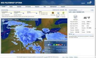
The WSI Pilotbrief Optima service's new mapping engine allows
high definition convective weather depiction and enhanced global
overlays. When combined with flight plan and airspace overlays, the
high definition weather information improves route planning and
builds confidence in decision making. The new release
also enables a high level of personalization and 'mid-task'
customization to further streamline pilot workflow.
"The release of WSI Pilotbrief Optima underscores our commitment to
extend WSI's leadership position in global aviation
weather-decision-support by delivering early insight into
disruptive weather conditions, no matter where pilots operate,"
said Mark D. Miller, VP of WSI's Decision Support.
Enhanced Pilotbrief Optima Features:
- High Definition (HD) Map - This powerful new mapping engine
combines unrivalled performance, high fidelity and personalization
to take the guess work out of mission planning.
- High Definition (HD) Weather Layers - This includes enhanced
Radar, Satellite IR, Vertically Integrated Liquid (VIL) and EchoTop
mosaics. Most notably, the new EchoTop mosaic offers a four-
fold improvement in spatial resolution that clearly shows the
highest tops of greatest concern, improving confidence in route
planning and decision making.
- Global Lightning - With an optional overlay to WSI's
proprietary Global Lightning Network (GLN), pilots can quickly
identify areas of strongest convective activity outside
ground-based weather radar range.
- SATrad - Derived from satellite imagery and high resolution
model data, WSI's proprietary SATrad provides a synthesized
depiction of convection throughout the tropics. When
combined with global lightning, pilots can pinpoint the areas of
strongest convection to avoid, improving safety and passenger
comfort.
- Enhanced Airport and Route Briefings - WSI's proprietary
briefing engine delivers the most relevant weather and NOTAM
information for your mission in a compact, easy to read and highly
transportable briefing package.
Over the next few months, WSI plans to release Pilotbrief Optima
for iPad, a lock-down browser version, and a kiosk version for
FBOs.
More News
Airbus Racer Demonstrator Makes Inaugural Flight Airbus Helicopters' ambitious Racer demonstrator has achieved its inaugural flight as part of the Clean Sky 2 initiative, a corners>[...]
A little Bit Quieter, Said Testers, But in the End it's Still a DA40 Diamond Aircraft recently completed a little pilot project with Lufthansa Aviation Training, putting a pair of >[...]
Line Up And Wait (LUAW) Used by ATC to inform a pilot to taxi onto the departure runway to line up and wait. It is not authorization for takeoff. It is used when takeoff clearance >[...]
Contributing To The Accident Was The Pilot’s Use Of Methamphetamine... Analysis: The pilot departed on a local flight to perform low-altitude maneuvers in a nearby desert val>[...]
From 2015 (YouTube Version): Overcoming Obstacles To Achieve Their Dreams… At EAA AirVenture 2015, FedEx arrived with one of their Airbus freight-hauling aircraft and placed>[...]
 Airbus Racer Helicopter Demonstrator First Flight Part of Clean Sky 2 Initiative

