Drone Power Line Inspection Begins In Nebraska | Aero-News Network
Aero-News Network
RSS icon RSS feed
podcast icon MP3 podcast
Subscribe Aero-News e-mail Newsletter Subscribe

Airborne Unlimited -- Most Recent Daily Episodes

Episode Date

Airborne-Monday

Airborne-Tuesday

Airborne-Wednesday Airborne-Thursday

Airborne-Friday

Airborne On YouTube

Airborne-Unlimited-04.29.24

Airborne-NextGen-04.30.24

Airborne-Unlimited-05.01.24 Airborne-AffordableFlyers--05.02.24

Airborne-Unlimited-05.03.24

Wed, Feb 12, 2020

Drone Power Line Inspection Begins In Nebraska

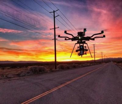
Aircraft Will Be Used To Take Photos Of Structures Along A High-Powered Transmission Line

Residents in northeast Nebraska may be seeing some drones flying around, as inspection work begins on a Nebraska Public Power District (NPPD) transmission line that extends from north of Norfolk, through Pierce County and into Antelope County.

Work is scheduled to begin Feb. 10, when drones will be used to take photos of structures along the high-powered transmission line. The photos are being taken so that NPPD can assess any maintenance work that may need to be completed along the line.

NPPD’s contractor, Valmont Utility, a business segment of Valmont Industries, Inc., will be conducting the drone work over a period of approximately five weeks and will be utilizing up to two drones simultaneously.  

“We recently conducted similar work on a transmission line in Fillmore County, and as we begin drone work in Madison, Pierce and Antelope counties, we want people to be aware of what’s going on,” says NPPD T&D Construction and Maintenance Manager Scott Walz. “The drones will be flying along our transmission lines and will only be operating during daytime hours.”

The drones will not be operating until at least 30 minutes after sunrise and will finish operating at least 30 minutes before sunset.

“Valmont partners with our key utility customers to understand the conditions of the assets required for grid reliability,” says Angi Chamberlain, Director of Quality for Valmont Utility. “The use of drones, or UAS, to survey and monitor the conditions of existing utility infrastructure allows a minimally invasive method to quickly ensure assets are in compliance with the original specifications and will maintain structural integrity over their lifetime. This is the most effective way to monitor the reliability of these critical assets,” adds Chamberlain.

(Source: Nebraska Public Power District news release. Image from file)

FMI: www.nppd.com

Advertisement

More News

ANN's Daily Aero-Term (05.01.24): Say Altitude

Say Altitude Used by ATC to ascertain an aircraft's specific altitude/flight level. When the aircraft is climbing or descending, the pilot should state the indicated altitude round>[...]

ANN's Daily Aero-Linx (05.01.24)

Aero Linx: European Air Law Association (EALA) EALA was established in 1988 with the aim to promote the study of European air law and to provide an open forum for those with an int>[...]

Classic Aero-TV: Korean War Hero Twice Reborn

From 2023 (YouTube Version): The Life, Death, Life, Death, and Life of a Glorious Warbird In 1981, business-owner Jim Tobul and his father purchased a Chance-Vought F4U Corsair. Mo>[...]

Airborne 04.29.24: EAA B-25 Rides, Textron 2024, G700 Deliveries

Also: USCG Retires MH-65 Dolphins, Irish Aviation Authority, NATCA Warns FAA, Diamond DA42 AD This summer, history enthusiasts will have a unique opportunity to experience World Wa>[...]

Airborne Affordable Flyers 05.02.24: Bobby Bailey, SPRG Report Cards, Skydive!

Also: WACO Kitchen Bails, French SportPlane Mfr to FL, Dynon-Advance Flight Systems, Innovation Preview Bobby Bailey, a bit of a fixture in sport aviation circles for his work with>[...]

blog comments powered by Disqus


Advertisement

Advertisement

Podcasts

Advertisement

© 2007 - 2024 Web Development & Design by Pauli Systems, LC