Enhancements Provide New Capabilities and Added Safety
 Garmin tells ANN that they have
added significant enhancements to their all-glass, G1000 integrated
avionics suite. These upgrades simplify operation, enhance
situational awareness and increase safety during flight and when
taxiing. Garmin's FliteCharts, ChartView, and SafeTaxi are on
display at Garmin's exhibit (#2853) at the NBAA Convention in
Orlando, Florida.
Garmin tells ANN that they have
added significant enhancements to their all-glass, G1000 integrated
avionics suite. These upgrades simplify operation, enhance
situational awareness and increase safety during flight and when
taxiing. Garmin's FliteCharts, ChartView, and SafeTaxi are on
display at Garmin's exhibit (#2853) at the NBAA Convention in
Orlando, Florida.
"These three major upgrades are yet another example of our
commitment to innovation and our continued effort to give customers
who fly G1000 equipped aircraft more resources and advantages than
any other avionics system on today's market," said Gary Kelley,
Garmin's vice president of marketing.
Garmin ChartView brings an electronic version of Jeppesen's
extensive library of charts and airport diagrams directly to the
G1000's Multi-Function Display (MFD). ChartView displays approach
charts, geopolitical features, airspace, airways and airport
diagrams. In addition, pilots will see the aircraft's present
position on the chart. These electronic charts greatly reduce the
amount of paper in the cockpit and help ease pilot workload.
Customers subscribing to ChartView will receive periodic DVD
updates from Jeppesen so they can update the information on the
aircraft. The DVD may also be loaded onto a personal computer to
display and print charts while on the ground.
Garmin FliteCharts is an electronic version of the National
Aeronautical Chart Office (NACO) U.S. Terminal Procedures
Publication. FliteCharts lets pilots quickly find and view all NACO
Departure Procedures (DP), Standard Terminal Arrival Routes
(STARs), approach charts, and airport diagrams on the MFD. G1000
equipped aircraft with FliteCharts will have access to all approach
plates currently published by NACO, which encompasses 17,500
approach plates at over 2,916 airports. Garmin will offer regular
updates to FliteCharts as they become available from NACO.
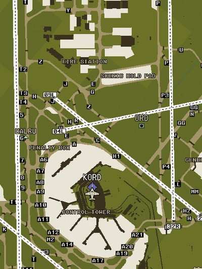
In addition to the terminal procedures available with ChartView
and FliteCharts, Garmin's SafeTaxi (shown below) is an
industry-leading service that helps pilots navigate unfamiliar
airports while taxiing. SafeTaxi identifies runways, taxiways, and
hangars, as well as the aircraft's exact location on the field. The
SafeTaxi information will be a standard feature integral in the
basemap and will be displayed on the G1000's MFD. Over 700 U.S.
airports and diagrams will be pre-loaded on G1000 equipped aircraft
with the SafeTaxi feature, and Garmin will continue to develop and
offer new airport charts as NACO provides new information. Garmin
also plans to offer international airport diagrams in the future,
pending approvals from the necessary agencies.
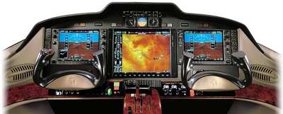
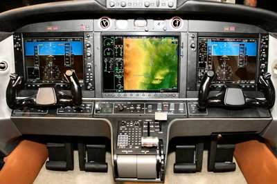
Garmin's all-glass, fully-integrated G1000 avionics suite is a
revolutionary design that has set a new standard for the aviation
industry. The lightweight, modular design and open architecture
continue Garmin's tradition of technology innovation. The system
integrates all primary flight, navigation, communication, terrain,
traffic, weather, engine instrumentation, and crew-alerting system
data, and presents the composite information on large-format
Primary Flight Displays (PFD) and MFD. The G1000 also includes the
GFC 700, the first entirely new autopilot designed and certified
for the 21st century. The GFC 700 is capable of using all data
available to the G1000 including the ability to maintain airspeed
references and to optimize performance over the entire airspeed
envelope.
 Aero-News: Quote of the Day (05.09.24)

