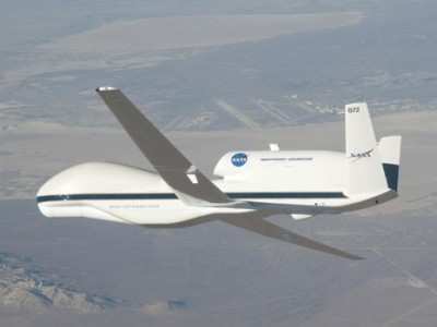
NASA's Global Hawk Completes First Scientific Flight
The first of five scientific flights by NASA's Global Hawk
autonomous UAV scheduled this month was completed successfully on
Wednesday. The aircraft flew just over 14 hours high above the
Pacific Ocean on an atmospheric study mission ... dubbed GloPac.
The study will eventually expand to the Arctic Ocean as well.
GloPac researchers plan to directly measure and sample
greenhouse gases, ozone-depleting substances, aerosols and
constituents of air quality in the upper troposphere and lower
stratosphere. GloPac's measurements will cover longer time periods
and greater geographic distances than any other science
aircraft.
"The Global Hawk is a revolutionary aircraft for science because
of its enormous range and endurance," said Paul Newman, co-mission
scientist for GloPac and an atmospheric scientist from NASA's
Goddard Space Flight Center in Greenbelt, MD. "No other science
platform provides the range and time to sample rapidly evolving
atmospheric phenomena. This mission is our first opportunity to
demonstrate the unique capabilities of this plane, while gathering
atmospheric data in a region that is poorly sampled."
During Wednesday's flight, the plane flew approximately 4,500
nautical miles along a flight path that took it to 150.3 degrees
West longitude, and 54.6 degrees North latitude, just south of
Alaska's Kodiak Island. The flight lasted just over 14 hours and
flew up to 60,900 feet. The mission is a joint project with
NOAA.
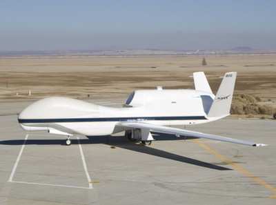
The plane carries 11 instruments to sample the chemical
composition of the troposphere and stratosphere, including two from
NASA's Jet Propulsion Laboratory, Pasadena, CA. The instruments
profile the dynamics and meteorology of both layers and observe the
distribution of clouds and aerosol particles. Project scientists
expect to take observations from the equator north to the Arctic
Circle and west of Hawaii.
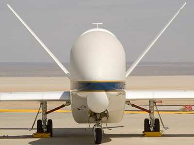
Although the plane is designed to fly on its own, pilots can
change its course or altitude based on interesting atmospheric
phenomena ahead. Researchers have the ability via communications
links to control their instruments from the ground. "The Global
Hawk is a fantastic platform because it gives us expanded access to
the atmosphere beyond what we have with piloted aircraft," said
David Fahey, co-mission scientist and a research physicist at
NOAA's Earth System Research Laboratory in Boulder, CO. "We can go
to regions we couldn't reach or go to previously explored regions
and study them for extended periods that are impossible with
conventional planes."
The timing of GloPac flights should allow scientists to observe
the breakup of the polar vortex. The vortex is a large-scale
cyclone in the upper troposphere and lower stratosphere that
dominates winter weather patterns around the Arctic and is
particularly important for understanding ozone depletion in the
Northern Hemisphere.
Scientists also expect to gather high-altitude data between
13,716 and 19,812 meters (45,000 and 65,000 feet), where many
greenhouse gases and ozone-depleting substances are destroyed. They
will measure dust, smoke and pollution that cross the Pacific from
Asia and Siberia and affect U.S. air quality.
Global Hawk will make several flights under NASA's Aura
satellite and other "A-train" Earth-observing satellites, "allowing
us to calibrate and confirm what we see from space," Newman added.
GloPac is specifically being conducted in conjunction with NASA's
Aura Validation Experiment.
GloPac includes more than 130 researchers and technicians from
Goddard, Dryden Flight Research Center, JPL, and Ames Research
Center in Moffett Field, Cai. Also involved are NOAA's Earth System
Research Laboratory; the University of California, Santa Cruz;
Droplet Measurement Technologies of Boulder, CO; and the University
of Denver.
 ANN's Daily Aero-Linx (05.02.24)

