Report: Global Aerial Imaging Market To Reach Nearly $2 Billion By 2019 | Aero-News Network
Aero-News Network
RSS icon RSS feed
podcast icon MP3 podcast
Subscribe Aero-News e-mail Newsletter Subscribe

Airborne Unlimited -- Most Recent Daily Episodes

Episode Date

Airborne-Monday

Airborne-Tuesday

Airborne-Wednesday Airborne-Thursday

Airborne-Friday

Airborne On YouTube

Airborne-Unlimited-05.06.24

Airborne-NextGen-05.07.24

Airborne-Unlimited-05.08.24 Airborne-FlightTraining-05.09.24

Airborne-Unlimited-05.10.24

Fri, Mar 07, 2014

Report: Global Aerial Imaging Market To Reach Nearly $2 Billion By 2019

Used For Natural Resource Management, Media, Construction And Development

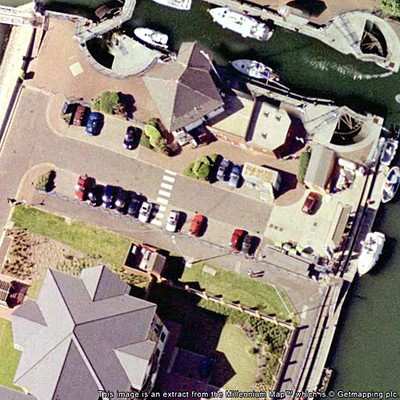
According to a new market report "Aerial Imaging Market - Global Industry Analysis, Size, Share, Growth, Trends, and Forecast, 2013 - 2019," published by Transparency Market Research, the market for aerial imaging globally is forecast to reach $1.994 billion by 2019. The market growth is driven by increased demand from applications such as natural resource management and construction & development. Real estate, urban planning and insurance are emerging as potential applications for aerial imagery and related services.

Globally, the aerial imaging market was valued at $869.2 million in 2012 and is forecast to grow at 12.8% CAGR (Compound Annual Growth Rate) from 2013 - 2019. Aerial imaging has been widely adopted across several end-use verticals such as commercial enterprises, government, civil engineering industry, forestry & agriculture, and energy sectors, among others. Among all, highest revenue share was contributed by the government sector in 2012, which together with commercial enterprises and forestry and agriculture, accounted for more than 50% of revenue share. Government organizations worldwide are progressively using aerial imagery and related services for numerous purposes such as homeland security, urban planning, energy sector management, and monitor environmental changes among others.

Aerial imagery and surveys are used for natural resources management, media & entertainment, construction & development, and 'conservation, research and study' among others. Construction & development, geospatial technology, and natural resource management are emerging as promising applications for aerial imaging industry. These three segments together accounted for 52.2% of market revenue share in 2012. Geographically, North America is expected to remain largest market for aerial imagery owing to the fast growing unmanned aerial vehicle (UAS) photography in this region. North America and Europe had collective revenue share of 80.1% in 2012.

(Image from file)

FMI: www.transparencymarketresearch.com

Advertisement

More News

Airborne-Flight Training 05.09.24: ERAU at AIAA, LIFT Diamond Buy, Epic A&P

Also: Vertical Flight Society, NBAA Maintenance Conference, GA Honored, AMT Scholarship For the first time, students from Embry-Riddle’s Daytona Beach, Florida, campus took t>[...]

ANN's Daily Aero-Term (05.07.24): Hazardous Weather Information

Hazardous Weather Information Summary of significant meteorological information (SIGMET/WS), convective significant meteorological information (convective SIGMET/WST), urgent pilot>[...]

Aero-News: Quote of the Day (05.07.24)

"The need for innovation at speed and scale is greater than ever. The X-62A VISTA is a crucial platform in our efforts to develop, test and integrate AI, as well as to establish AI>[...]

NTSB Final Report: Cessna 150

(FAA) Inspector Observed That Both Fuel Tanks Were Intact And That Only A Minimal Amount Of Fuel Remained In Each Analysis: According to the pilot, approximately 8 miles from the d>[...]

Aero-News: Quote of the Day (05.08.24)

“Pyka’s Pelican Cargo is unlike any other UAS solution on the market for contested logistics. We assessed a number of leading capabilities and concluded that the Pelica>[...]

blog comments powered by Disqus


Advertisement

Advertisement

Podcasts

Advertisement

© 2007 - 2024 Web Development & Design by Pauli Systems, LC