Pilot, Two Passengers Killed In August 7th Incident
 The NTSB has issued a preliminary
report in the mid-flight breakup of a Navion A in Adrian, Oregon
which killed all three people on board the aircraft. The report
contains only preliminary findings, and assigns no cause for the
accident.
The NTSB has issued a preliminary
report in the mid-flight breakup of a Navion A in Adrian, Oregon
which killed all three people on board the aircraft. The report
contains only preliminary findings, and assigns no cause for the
accident.
NTSB Identification: WPR09FA391
14 CFR Part 91: General Aviation
Accident occurred Friday, August 07, 2009 in Adrian, OR
Aircraft: NAVION NAVION A, registration: N4898K
Injuries: 3 Fatal.
This is preliminary information, subject to change, and may contain
errors. Any errors in this report will be corrected when the final
report has been completed.
On August 07, 2009, about 1200 mountain daylight time, a Navion
A, N4898K, was destroyed during an in-flight breakup near Adrian,
Oregon. The pilot, who had recently purchased the airplane, was
operating it under the provisions of 14 CFR Part 91. The private
pilot and two passengers were killed. The cross-country personal
flight departed the Jerome Country Airport, Jerome, Idaho, about
1030, with a planned final destination of Ilwaco, Washington.
Instrument meteorological conditions prevailed in the area
surrounding the accident site; no flight plan was filed.
During a telephone conversation with a Safety Board
investigator, the pilot's uncle stated that the pilot was flying
himself and his brother and father to Ilwaco for a weekend fishing
trip. The flight departed from a private landing strip in Idaho to
Jerome, where they added 35.6 gallon of fuel.
Preliminary recorded radar data covering the area of the
accident was supplied by the Federal Aviation Administration (FAA).
The radar data was analyzed for the time frame and proximity to the
anticipated flight track of the airplane en route from Jerome.
The radar data consisted of approximately equidistant primary
radar return from Jerome heading west to Murphy, Idaho. The returns
continued west for several miles followed by an 180-degree course
reversal. The track then diverted northeast for about 15 miles, and
then continued in the westerly direction for about 10 miles until
temporarily disappearing. The returns resumed after about 4 miles
and made a right 360-degree turn. The accident site was located
within that radar return circle.
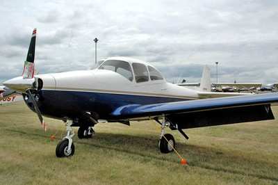
Navion File Photo
The closest weather facility was near Owyhee Ridge, Oregon,
about 13 miles from the accident site. At 1141, it recorded a
temperature of 49 degrees Fahrenheit and a dew point of 49 degrees
Fahrenheit. The temperature and dew point both lowered to 48
degrees Fahrenheit at 1211. Overcast cloud conditions at 2,900 feet
agl were also reported.
The accident site was located in the eastern canyon of Succor
Creek, about 25 nautical mile (nm) south of Adrian. The main
wreckage was located at an estimated 43 degrees 26.389 minutes
north latitude and 117 degrees 05.158 minutes west longitude, at an
elevation of about 3,900 feet mean sea level (msl).
The wreckage debris was scattered over an estimated 1,000-foot
area of hilly terrain. At the far south premise of the debris field
were large sections of the right wing, with the far north area
containing the engine and nose landing wheel.
The wreckage was recovered to a secure location for further
examination.
 Unfortunate... ANN/SportPlane Resource Guide Adds To Cautionary Advisories

