Thu, Jan 19, 2012
Latest Version Improves Worldwide Tracking And Avoidance Of
Flight Hazards
WSI (Weather Services International) said Tuesday it will soon
be releasing WSI Fusion 4.2. The new version, which will be
available by the end of January, further extends WSI Fusion's
global weather and flight management capabilities for improved
operational efficiency, safety and global decision-support.
"WSI Fusion enables operators to be aware of and stay ahead of
disruptive, hazardous weather conditions. These capabilities keep
flights and passengers safe and on schedule," said John Szatkowski,
WSI Senior Product Manager. "With the addition of Australian and
European Radar, both with precipitation type, this release offers
the tracking and avoidance of enroute and terminal hazards on a
world-wide basis.
Driven by user feedback, Fusion 4.2 delivers the following
enhancements:
- Australian Radar - Coverage of radar-based precipitation across
the Australian continent, updated every 15 minutes. This further
increases WSI's international radar availability.
- European Radar with Precipitation Type - As an enhancement to
the existing European radar coverage, users may clearly see areas
of freezing rain and snow without having to overlay additional
layers or reference additional sources.
- In addition, Fusion 4.2 offers unparalleled options to
streamline workflow and gain system-wide efficiencies. These
include:
- North American Radar Mosaic - Providing a comprehensive view of
radar returns from Canada through the tropics, with recently
increased coverage of Mexico and the Caribbean.
- Active SUAs (Special Use Airspace) - Indicating which US
Special Use Airspace regions are currently in use or reserved for
the operational day.
- Enterprise and Flight Planning Interfaces, including relevant
Alerting - Integrating customer data from external sources to
enable optimal flight following and routing choices.
- Updated Web Based Training portal - An online training site
that includes all of WSI's newest Fusion features.
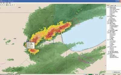
WSI Fusion is designed to facilitate proactive operations
management by providing early insight into changing flight,
airfield and airspace conditions while streamlining the
decision-making workflow. The solution combines global, public and
proprietary weather information, airspace constraints, flight track
information and navigation data, including NOTAMs, into a unified,
clear operational picture, taking the guesswork out of situational
decisions. Flight operators benefit through improved operational
efficiencies and safety, especially during potentially disruptive
weather events.
More News
Airbus Racer Demonstrator Makes Inaugural Flight Airbus Helicopters' ambitious Racer demonstrator has achieved its inaugural flight as part of the Clean Sky 2 initiative, a corners>[...]
A little Bit Quieter, Said Testers, But in the End it's Still a DA40 Diamond Aircraft recently completed a little pilot project with Lufthansa Aviation Training, putting a pair of >[...]
Line Up And Wait (LUAW) Used by ATC to inform a pilot to taxi onto the departure runway to line up and wait. It is not authorization for takeoff. It is used when takeoff clearance >[...]
Contributing To The Accident Was The Pilot’s Use Of Methamphetamine... Analysis: The pilot departed on a local flight to perform low-altitude maneuvers in a nearby desert val>[...]
From 2015 (YouTube Version): Overcoming Obstacles To Achieve Their Dreams… At EAA AirVenture 2015, FedEx arrived with one of their Airbus freight-hauling aircraft and placed>[...]
 Airbus Racer Helicopter Demonstrator First Flight Part of Clean Sky 2 Initiative

