Fri, Oct 18, 2013
First RNR AR Project In Xinjiang Completes Demonstration Flights In Difficult Terrain
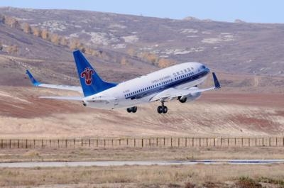
Demonstration flights using Required Navigation Performance – Authorization Required (RNP-AR) procedures were successfully completed recently at the Kanas Airport, Xinjiang Province, China. The Kanas procedure development, which is the first RNR AR implementation in the Xinjiang Region, is also the first collaborative RNP AR project between China Southern Airlines and Boeing. The demonstration flights were conducted using the 4000th Boeing Next-Generation 737.
Opened in 2007, Kanas Airport is a seasonal airport in a valley of the Altay Mountains that mainly serves tourists to the Kanas Nature Reserve, a natural ecosystem formed by lakes, rivers, glaciers, forests and grasslands. However, weather conditions in the area can be difficult for aviation; flights are often held, diverted to other airports or even cancelled.
To address these challenges, the Kanas RNP AR project was launched under a cooperative agreement between the Civil Aviation Administration of China (CAAC) Flight Standards group, the Xinjiang CAAC, China Southern Airlines, the Xinjiang Airport Group and Boeing. Boeing provided air traffic controller training on the new procedures to ensure a smooth transition and proper implementation of RNP AR. Teams from Jeppesen, a Boeing subsidiary, designed, charted and helped obtain certification for the instrument flight procedures, while other Boeing teams led the overall project and trained China Southern Airlines’ dispatchers and flight crews.
RNP AR is the most capable form of air navigation, enabling airplanes to use Global Navigation Satellite Systems (GNSS) and onboard avionics to fly precisely predefined flight paths without reliance on ground-based navigation stations. It enables curved approach paths that can avoid difficult terrain or noise-sensitive areas and shortens flight tracks to the runway. It is normally used where conventional ground-based navigation is not as effective.
The benefits of the Kanas RNP project include more precise flight operations, increased access to the airport even in low visibility conditions, shorter flight times and reduced fuel consumption, noise and emissions. “Providing this service to our customers – helping them use the advanced capabilities of their airplanes to enhance safety and improve their bottom line efficiency – is a great opportunity to demonstrate what the Boeing Edge is all about,” said Chuck Steigerwald, Manager of Boeing Airspace Solutions. “We are thrilled to help make this breakthrough in our work with our Chinese aviation partners.”
After obtaining CAAC approval, Kanas Airport will be the first location in China where RNP AR procedures will take advantage of RNP levels of less than 0.2 nautical miles. A lower RNP value represents more accurate navigation; airplanes flying with this level of precision reduce flight miles and thus save fuel and reduce costs for an airline.
Earlier in the week, the Boeing team supported another successful demonstration flight at the Lijiang airport in the South West province of Yunnan where RNP AR procedures were re-designed to accommodate a new airspace infrastructure and a runway construction project. Boeing originally developed RNP AR procedures at Lijiang in 2008 in conjunction with China Eastern and local CAAC.
(Image provided by Boeing)
More News
The Industry Continues to be Rocked By Some Questionable Operations Recent investigations and a great deal of data has resulted in ANN’s SportPlane Resource Guide’s rep>[...]
Make Sure You NEVER Miss A New Story From Aero-News Network Do you ever feel like you never see posts from a certain person or page on Facebook or Instagram? Here’s how you c>[...]
Visual Approach Slope Indicator (VASI) An airport lighting facility providing vertical visual approach slope guidance to aircraft during approach to landing by radiating a directio>[...]
Airport Marking Aids Markings used on runway and taxiway surfaces to identify a specific runway, a runway threshold, a centerline, a hold line, etc. A runway should be marked in ac>[...]
Aero Linx: The Skyhawk Association The Skyhawk Association is a non-profit organization founded by former Skyhawk Pilots which is open to anyone with an affinity for the A-4 Skyhaw>[...]
 Unfortunate... ANN/SportPlane Resource Guide Adds To Cautionary Advisories

