Jeppesen Provides A Better Picture Of Hazardous Weather With New Lightning Maps | Aero-News Network
Aero-News Network
RSS icon RSS feed
podcast icon MP3 podcast
Subscribe Aero-News e-mail Newsletter Subscribe

Airborne Unlimited -- Most Recent Daily Episodes

Episode Date

Airborne-Monday

Airborne-Tuesday

Airborne-Wednesday Airborne-Thursday

Airborne-Friday

Airborne On YouTube

Airborne-Unlimited-04.22.24

Airborne-Unlimited-04.16.24

Airborne-FlightTraining-04.17.24 Airborne-AffordableFlyers-04.18.24

Airborne-Unlimited-04.19.24

Tue, Jul 19, 2005

Jeppesen Provides A Better Picture Of Hazardous Weather With New Lightning Maps

I Can See Clearly Now...

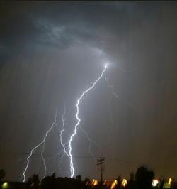
Jeppesen says it's recently started adding lightning weather maps to its lineup of weather products. The lightning data is provided by the US Precision Lightning Network (USPLN), a partnership between TOA Systems and Weather Decisions Technologies (WDT). TOA Systems designed, built and installed the lightning sensors, and WDT distributes the data and provides applications that display the data.

New technology allows the detection of both cloud-to-ground lightning as well as lightning within clouds. Cloud-to-cloud lightning data is highly pertinent to pilots and dispatchers—typically more than 70 percent of all lightning strikes happen within clouds. Before Jeppesen began offering these new weather maps, only cloud-to-ground lightning data was available. By utilizing the latest technologies, Jeppesen is now able to provide a more complete lightning picture to its customers. The new lightning charts rely on 90 sensors across the United States that regularly detect lightning strikes as far away as northern Canada, the Caribbean, Mexico, Latin America, northern South America and the eastern Pacific out to Hawaii.

Jeppesen will offer USPLN lightning data as separate maps that are updated every 10-15 minutes as well as lightning data with infrared and visible satellite images. In areas outside of the NEXRAD radar network, lightning data is the best way to determine if convective activity and thunderstorms are present. The display software allows Jeppesen to show past lightning strikes as well as current strikes, so users can see trends in the activity. This is helpful in determining if a thunderstorm is growing or decaying and showing the movement of the active cells.

"The addition of the USPLN lightning data to Jeppesen's weather products is another step in providing the best aviation weather information to our customers," said Mike Cetinich, product manager. "With the recent additions of a NEXRAD forecast product, worldwide turbulence and icing maps, and now the USPLN lightning data, Jeppesen is at the forefront of state-of-the-art aviation weather products. We are committed and solely focused on aviation weather products that add value for the customer, and help them make more informed decisions."

FMI: www.jeppesen.com

Advertisement

More News

ANN's Daily Aero-Term (04.26.24): DETRESFA (Distress Phrase)

DETRESFA (Distress Phrase) The code word used to designate an emergency phase wherein there is reasonable certainty that an aircraft and its occupants are threatened by grave and i>[...]

ANN's Daily Aero-Linx (04.26.24)

Aero Linx: The International Association of Missionary Aviation (IAMA) The International Association of Missionary Aviation (IAMA) is comprised of Mission organizations, flight sch>[...]

Airborne 04.22.24: Rotor X Worsens, Airport Fees 4 FNB?, USMC Drone Pilot

Also: EP Systems' Battery, Boeing SAF, Repeat TBM 960 Order, Japan Coast Guard H225 Buy Despite nearly 100 complaints totaling millions of dollars of potential fraud, combined with>[...]

Airborne 04.24.24: INTEGRAL E, Elixir USA, M700 RVSM

Also: Viasat-uAvionix, UL94 Fuel Investigation, AF Materiel Command, NTSB Safety Alert Norges Luftsportforbund chose Aura Aero's little 2-seater in electric trim for their next gli>[...]

Airborne-NextGen 04.23.24: UAVOS UVH 170, magni650 Engine, World eVTOL Directory

Also: Moya Delivery Drone, USMC Drone Pilot, Inversion RAY Reentry Vehicle, RapidFlight UAVOS has recently achieved a significant milestone in public safety and emergency services >[...]

blog comments powered by Disqus


Advertisement

Advertisement

Podcasts

Advertisement

© 2007 - 2024 Web Development & Design by Pauli Systems, LC