Mon, Sep 27, 2010
While ANN was running around/amok at Oshkosh (much like a
certain poultry product sans any evidence of cranial capacity), we
were hard-pressed to keep up with all the goodies that were
presented... but the crowds surrounding the Jepp building convinced
us that it was worth spending a few hours there... and we were NOT
disappointed.
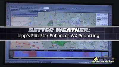
During the annual aerial love-fest at Oshkosh, Jepp took the
wraps off a new version of its new FliteStar flight planning
program that now includes enhanced global weather data services.
Jeppesen FliteStar users will now be able to improve situational
awareness through receiving continually updated weather
information. Weather data is now presented through multiple
customized graphical formats displayed according to FliteStar
coverage area, user preference and flight plan.

The ground-based FliteStar version 9.5 presents users with a
dynamic graphical view of the weather environment in both enroute
and profile views and reduces the need to switch between enroute
and weather displays. Jeppesen weather data now aligns with the
FliteStar coverage area purchased and weather download overlay
displays are presented on enroute charts and are updated
automatically through an Internet connection. The new version of
the FliteStar program provides a new tool to view current weather
at or near the time of departure plus forecast weather along a
route and at a user’s planned destination. The weather
service combines current data from the National Weather Service and
other sources, including NEXRAD mosaic data and includes critical
icing and turbulence information.
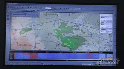
Weather elements included in the new FliteStar version includes
AIRMETs, SIGMETs, radar, lighting, surface analysis, METARs, icing,
turbulence and wind data. A new weather toolbar gives users the
ability to display or close these graphical elements, according to
user preference. A new “chart time slider” feature
allows users to view current weather for the flight plan and a new
“weather legend” graphical element shows all currently
displayed weather elements. An “icing” display bar
allows users to formulate an ice-avoidance strategy and flight plan
before leaving the ground. By the way, ANN is currently evaluating
a copy of the latest version of FliteStar and the weather
capabilities are every bit as slick as promised. The current
version of FligteStar is packed to the gills with features and
we're looking forwards to checking each of them out... More news to
follow. In the meantime, though, check out the Aero-TV interview
with the folks at Jepp about the new weather reporting functions
built into FliteStar.
More News
Hold Procedure A predetermined maneuver which keeps aircraft within a specified airspace while awaiting further clearance from air traffic control. Also used during ground operatio>[...]
Altitude Readout An aircraft’s altitude, transmitted via the Mode C transponder feature, that is visually displayed in 100-foot increments on a radar scope having readout cap>[...]
Aero Linx: European Hang Gliding and Paragliding Union (EHPU) The general aim of the EHPU is to promote and protect hang gliding and paragliding in Europe. In order to achieve this>[...]
Also: Skydio Chief, Uncle Sam Sues, Dash 7 magniX, OR UAS Accelerator US Secretary of the Air Force Frank Kendall was given a turn around the patch in the 'X-62A Variable In-flight>[...]
"The need for innovation at speed and scale is greater than ever. The X-62A VISTA is a crucial platform in our efforts to develop, test and integrate AI, as well as to establish AI>[...]
 ANN's Daily Aero-Term (05.09.24): Hold Procedure

