Tue, Jun 10, 2014
Flights May Be Conducted Over Campuses To Create Infrastructure Map
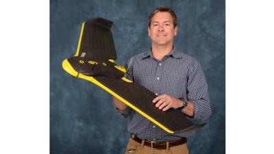
Texas A&M University-Corpus Christi has received approval from the FAA to fly its small-scale unmanned aircraft system (UAS) platform over the campus to map the infrastructure of both the main Island University and the Momentum Campus.
University officials say that this approval will help prepare graduate students in Geographic Information Science (GIS) and Geospatial Surveying Engineering (GSEN) for real-world situations, opportunities that they cannot receive anywhere else.
“This is one of the first operations we are aware of that has been approved by the FAA to allow a small unmanned aircraft to fly an entire university campus on a recurring basis,” said Dr. Michael Starek, Assistant Professor of GIS and GSEN. “We will use imagery acquired by the system to monitor campus facilities and derive 3-D models of the infrastructure as well as to monitor shoreline change and assess coastal hazards facing our island campus.”
Texas A&M-Corpus Christi students have already been assisting the University with numerous survey projects that include utility mapping, road construction, and boundary delineations.
“This program truly is a win-win in every aspect,” said Kathryn Funk-Baxter, Executive Vice President for Finance and Administration. “Each aerial flight conducted by a student saves the University around $1,500 and provides the University students with real life experiences. When they do an aerial survey using ground control GPS coordinates to acquire survey grade data, this would likely result in a savings of up to $200,000 had the survey been contracted by a firm to perform.”
The students have been hands-on in numerous University-related projects. Those include establishing accurate survey controls on both campuses to ensure all surveying projects are connected to the Master Plan; field surveying construction progress of Momentum campus and Curlew Plaza; verifying boundaries of ground leases on University property, developing a standard operating procedure; and evaluating the Computer Aided Design Master Plan and accurately locating all new projects for the University administration.
(Image provided by Texas A&M University)
More News
Airport Marking Aids Markings used on runway and taxiway surfaces to identify a specific runway, a runway threshold, a centerline, a hold line, etc. A runway should be marked in ac>[...]
"It is extremely difficult, if not impossible, for manned aircraft to see a drone while conducting crop-enhancing and other aerial applications at low altitudes and high speeds. We>[...]
Aero Linx: The Skyhawk Association The Skyhawk Association is a non-profit organization founded by former Skyhawk Pilots which is open to anyone with an affinity for the A-4 Skyhaw>[...]
“The T-54A benefits from an active Beechcraft King Air assembly line in Wichita, Kansas, where all required METS avionics and interior modifications are installed on the line>[...]
Aero Linx: Aerostar Owners Association The Association offers the Aerostar Owner a unique opportunity to tap an invaluable source of information concerning the care and feeding of >[...]
 ANN's Daily Aero-Term (04.28.24): Airport Marking Aids

