Garmin Unveils Expanded Aviation Charting Capability For Europe | Aero-News Network
Aero-News Network
RSS icon RSS feed
podcast icon MP3 podcast
Subscribe Aero-News e-mail Newsletter Subscribe

Airborne Unlimited -- Most Recent Daily Episodes

Episode Date

Airborne-Monday

Airborne-Tuesday

Airborne-Wednesday Airborne-Thursday

Airborne-Friday

Airborne On YouTube

Airborne-Unlimited-05.13.24

Airborne-NextGen-05.07.24

Airborne-Unlimited-05.08.24 Airborne-FlightTraining-05.09.24

Airborne-Unlimited-05.10.24

Thu, Apr 19, 2012

Garmin Unveils Expanded Aviation Charting Capability For Europe

Teams With Jeppesen To Integrate European VFR Terminal Charts

Garmin has introduced expanded electronic charting capabilities for Europe, including the availability of European VFR terminal charts and European SafeTaxi airport diagrams for select Garmin aviation products.

“European pilots have asked Garmin to find ways to provide information electronically that helps enhance situational awareness. With these new electronic charts, pilots not only benefit from a less-cluttered cockpit, but they allow for more immediate access to the information pilots need to make good decisions,” said Carl Wolf, Garmin’s vice president of aviation sales and marketing.

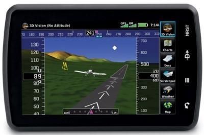
Garmin has partnered with Jeppesen to integrate their European VFR terminal charts into the aera 795/796 aviation portables. By loading the VFR terminal charts on to the Garmin portable, pilots meet the requirement for carrying charts, but without the burden of having additional paper in the cockpit. The database covers over 2,200 airports in 29 European countries and contains colored Visual Approach, Landing and Area Charts, as well as general- and country-related text sections such as Regulations, Communications, Meteorology, Aerodrome Directory and more for the planning and execution of flights within Europe under Visual Flight Rules.

Garmin also introduced a new European SafeTaxi database, offering geo-referenced airport diagrams for nearly 500 European airports in 15 different countries. SafeTaxi automatically identifies runways, taxiways, FBOs, and hangars, as well as the aircraft's location on the field. Because SafeTaxi is geo-referenced, pilots will experience enhanced situational awareness by seeing their aircraft move along the taxiway diagram on the navigation screen. European SafeTaxi is available today as an update option for select Garmin portables, the GTN 650/750 series and the G3X glass flight display. Within weeks, the European Aviation Safety Agency (EASA) is expected to approve European Safe Taxi for Garmin’s G500, G600, G500H, G1000, G1000H, G900X, G950, and GMX 200 platforms.

Both of these expanded charting capabilities are complemented by Garmin’s electronic AC-U-KWIK airport directory, a global airport directory available for select Garmin aviation portables and glass flight decks.

The European VFR terminal charts for the aera 795/796 are available via the purchase of a Garmin ChartView key available from flyGarmin and a subscription from Jeppesen. The ChartView key will be available at no additional charge for those purchasing an aera 795/796 at AERO Friedrichshafen from April 18 to April 21, 2012. For those unable to attend the show, the ChartView key will be available at a special price of $199 beginning today through August 31, 2012.

FMI: http://flyGarmin.com

Advertisement

More News

Bolen Gives Congress a Rare Thumbs-Up

Aviation Governance Secured...At Least For a While The National Business Aviation Association similarly applauded the passage of the FAA's recent reauthorization, contentedly recou>[...]

The SportPlane Resource Guide RETURNS!!!!

Emphasis On Growing The Future of Aviation Through Concentration on 'AFFORDABLE FLYERS' It's been a number of years since the Latest Edition of Jim Campbell's HUGE SportPlane Resou>[...]

Buying Sprees Continue: Textron eAviation Takes On Amazilia Aerospace

Amazilia Aerospace GmbH, Develops Digital Flight Control, Flight Guidance And Vehicle Management Systems Textron eAviation has acquired substantially all the assets of Amazilia Aer>[...]

Hawker 4000 Bizjets Gain Nav System, Data Link STC

Honeywell's Primus Brings New Tools and Niceties for Hawker Operators Hawker 4000 business jet operators have a new installation on the table, now that the FAA has granted an STC f>[...]

Echodyne Gets BVLOS Waiver for AiRanger Aircraft

Company Celebrates Niche-but-Important Advancement in Industry Standards Echodyne has announced full integration of its proprietary 'EchoFlight' radar into the e American Aerospace>[...]

blog comments powered by Disqus


Advertisement

Advertisement

Podcasts

Advertisement

© 2007 - 2024 Web Development & Design by Pauli Systems, LC