Mon, Nov 04, 2019
Shows Detailed Coastlines, Terrain Peaks, Roads, and More
ForeFlight’s new High Resolution Basemap dramatically improves the level of detail visible on the map. View detailed coastlines for rivers, lakes, and oceans to help with visual navigating, and new terrain peak markers with elevation labels for greater terrain awareness.
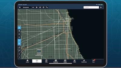
Other improvements include more detailed roads and railways, urban areas, forests and national parks, and more. ForeFlight automatically downloads the new basemap for your region after you update so you can see the improvements right away.
ForeFlight’s October release also brings map layer multi-select with the “Multiple Selections” setting, AOPA FBO Fees for U.S. airports, a new “Safety Distance Factor” setting for Takeoff & Landing Performance calculations, and more.
Toggle multiple map layers without having to reopen the Layer Selector each time. Enable the new "Multiple Selections" setting at the bottom of the Map Settings menu, or in More > Settings > Layer Selector. You can also now pan and zoom around the map while the layer selector is open, even if the Multiple Selections setting is disabled.
View detailed FBO fees sourced from AOPA’s Airport Directory to help you make more informed flight planning decisions. Access fee information in the new Fees tab of the FBO detail view. For each FBO ForeFlight lists the type of fee, the fee amount, any notes, and a detailed breakdown for fees that vary by aircraft type.
Increase your safety margins for Takeoff & Landing Performance calculations based on runway conditions and other factors. ForeFlight multiplies the initial distance amount by the Safety Distance Factor to produce the final result, and automatically applies your last-used factor for future flights with the same aircraft.
ForeFlight can now automatically fill certain Logbook fields based on a flight’s Total Time, simplifying the process of filling in new entries. Select the fields you want to auto-fill in More > Logbook > Settings > Auto-Fill Settings.
(Image from ForeFlight YouTube video. Source: ForeFlight news release)
More News
From 2023 (YouTube Version): Legacy of a Titan Robert (Bob) Anderson Hoover was a fighter pilot, test pilot, flight instructor, and air show superstar. More so, Bob Hoover was an i>[...]
Get The Latest in Aviation News NOW on Instagram Are you on Instagram yet? It's been around for a few years, quietly picking up traction mostly thanks to everybody's new obsession >[...]
Aero Linx: B-52H Stratofortress The B-52H Stratofortress is a long-range, heavy bomber that can perform a variety of missions. The bomber is capable of flying at high subsonic spee>[...]
Altimeter Setting The barometric pressure reading used to adjust a pressure altimeter for variations in existing atmospheric pressure or to the standard altimeter setting (29.92).>[...]
"Knowing that we play an active part in bettering people's lives is extremely rewarding. My team and I are very thankful for the opportunity to be here and to help in any way we ca>[...]
 Classic Aero-TV: Remembering Bob Hoover

