Delair Unveils A New Large-Area Mapping Drone | Aero-News Network
Aero-News Network
RSS icon RSS feed
podcast icon MP3 podcast
Subscribe Aero-News e-mail Newsletter Subscribe

Airborne Unlimited -- Most Recent Daily Episodes

Episode Date

Airborne-Monday

Airborne-Tuesday

Airborne-Wednesday Airborne-Thursday

Airborne-Friday

Airborne On YouTube

Airborne-Unlimited-05.13.24

Airborne-NextGen-05.07.24

Airborne-Unlimited-05.08.24 Airborne-FlightTraining-05.09.24

Airborne-Unlimited-05.10.24

Sat, Sep 30, 2017

Delair Unveils A New Large-Area Mapping Drone

Aircraft Features 3G/4G Communications And Onboard Processing Capabilities

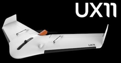
Drone manufacturer Delair has introduced its next-generation professional unmanned aerial vehicle (UAV) for survey-grade photogrammetric mapping, the UX11, at INTERGEO 2017 in Berlin, Germany. This small fixed-wing UAV combines a powerful integrated onboard system, industry-grade sensors, limitless communication range and PPK centimeter-level positioning.

The UX11 carries enough onboard computing power to access and process the pictures, then send them to the operator in real-time. It will run automated quality checks on the images (such as blur detection or overlap checks) to help ensure the operator is acquiring quality data.

The UX11's redundant communications system includes a proprietary line of sight radio and 3G/4G connectivity between the ground control station and the UAV using a worldwide machine-to-machine pre-paid plan. Building on Delair's experience with beyond visual line of sight (BVLOS) operations since 2012, the UX11 is ready for BVLOS flights with unlimited range and adds a new level of safety with this groundbreaking communication link.

"The UX11 by Delair is the ultimate solution for geospatial professionals that demand large-area mapping with centimeter-level precision," said Michael de Lagarde, Delair's CEO. "The UX11 will be capable of using its camera for enhanced safety procedures and even running early-stage pre-processing calculations onboard in real time using photogrammetry and deep learning algorithms. This expedites subsequent steps in the data processing chain for an optimized workflow. With the UX11, everything is done for a clear and efficient user experience."

(Source: Deair news release. Image provided)

FMI: www.delair.aero

Advertisement

More News

Bolen Gives Congress a Rare Thumbs-Up

Aviation Governance Secured...At Least For a While The National Business Aviation Association similarly applauded the passage of the FAA's recent reauthorization, contentedly recou>[...]

The SportPlane Resource Guide RETURNS!!!!

Emphasis On Growing The Future of Aviation Through Concentration on 'AFFORDABLE FLYERS' It's been a number of years since the Latest Edition of Jim Campbell's HUGE SportPlane Resou>[...]

Buying Sprees Continue: Textron eAviation Takes On Amazilia Aerospace

Amazilia Aerospace GmbH, Develops Digital Flight Control, Flight Guidance And Vehicle Management Systems Textron eAviation has acquired substantially all the assets of Amazilia Aer>[...]

Hawker 4000 Bizjets Gain Nav System, Data Link STC

Honeywell's Primus Brings New Tools and Niceties for Hawker Operators Hawker 4000 business jet operators have a new installation on the table, now that the FAA has granted an STC f>[...]

Echodyne Gets BVLOS Waiver for AiRanger Aircraft

Company Celebrates Niche-but-Important Advancement in Industry Standards Echodyne has announced full integration of its proprietary 'EchoFlight' radar into the e American Aerospace>[...]

blog comments powered by Disqus


Advertisement

Advertisement

Podcasts

Advertisement

© 2007 - 2024 Web Development & Design by Pauli Systems, LC