Tue, Jan 11, 2005
Putting The Third Dimension In 3D
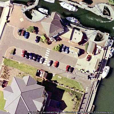
 Aerial mapping company BlueSky
Monday launched Point-Z, a national database of land and building
height measurements that holds the height above sea level for any
given point in Great Britain. Point-Z comprises a grid of billions
of survey points collected every 5 meters or less using
sophisticated remote sensing technology. Height accuracy varies
from less than 1 meter to as little as 5 centimeters for selected
areas such as high-risk flood plains and coastal zones.
Aerial mapping company BlueSky
Monday launched Point-Z, a national database of land and building
height measurements that holds the height above sea level for any
given point in Great Britain. Point-Z comprises a grid of billions
of survey points collected every 5 meters or less using
sophisticated remote sensing technology. Height accuracy varies
from less than 1 meter to as little as 5 centimeters for selected
areas such as high-risk flood plains and coastal zones.
Point-Z data has many applications from civil engineering, flood
risk assessment, and quarrying to mobile network planning, railway
engineering and personal navigation. The Point-Z database is
revolutionary as it is based entirely upon data collected by remote
sensing. It replaces traditional contour maps drawn from costly and
time consuming land surveying work. Point Z data creates a much
more accurate contour map captured electronically using remote
sensing.
Most notable in the Point-Z database is NEXTMap Britain, a new
terrain map of the whole of Great Britain created by Intermap
Technologies. This groundbreaking national mapping project took
only two years to complete and involved a Learjet specially
equipped with a highly accurate Radar sensor flying at night at an
altitude of over 20,000 ft to scan the land with unprecedented
accuracy.
Additional Point-Z data is derived from other remote sensing
methods such as aerial photography and LIDAR (Light Detection and
Ranging), which is used for areas where centimeter accuracy is
required. The standard format is an XYZ text file, but other
formats for more experienced users across a range of software are
also available. Every individual point in the Point-Z database will
be tagged to provide information (meta data) about the grid
spacing, height accuracy, date, acquisition method, copyright and
whether it is an bald earth indicator or a first surface height for
features such as trees or buildings.
Elevation points may be used in isolation but their real value
lies in providing the 3rd dimension in maps when viewed as contours
or with software to create cross sections and most spectacularly
real world visualizations and fly-throughs when matched to aerial
photography. These 3D landscapes and cityscapes, can be modelled to
reflect proposed development such as new buildings, roads and
quarries as a useful aid for planners, architects and civil
engineers. Applications for road vehicle telemetry and synthetic
vision for fog bound aircraft are also being developed.
More News
Airbus Racer Demonstrator Makes Inaugural Flight Airbus Helicopters' ambitious Racer demonstrator has achieved its inaugural flight as part of the Clean Sky 2 initiative, a corners>[...]
A little Bit Quieter, Said Testers, But in the End it's Still a DA40 Diamond Aircraft recently completed a little pilot project with Lufthansa Aviation Training, putting a pair of >[...]
Line Up And Wait (LUAW) Used by ATC to inform a pilot to taxi onto the departure runway to line up and wait. It is not authorization for takeoff. It is used when takeoff clearance >[...]
Contributing To The Accident Was The Pilot’s Use Of Methamphetamine... Analysis: The pilot departed on a local flight to perform low-altitude maneuvers in a nearby desert val>[...]
From 2015 (YouTube Version): Overcoming Obstacles To Achieve Their Dreams… At EAA AirVenture 2015, FedEx arrived with one of their Airbus freight-hauling aircraft and placed>[...]
 Airbus Racer Helicopter Demonstrator First Flight Part of Clean Sky 2 Initiative

