Sets The Stage For Measuring Snowfall From Space
Beginning Jan. 17, NASA will fly an airborne science laboratory
above Canadian snowstorms to tackle a difficult challenge facing
the upcoming Global Precipitation Measurement (GPM) satellite
mission -- measuring snowfall from space. GPM is an international
satellite mission that will set a new standard for precipitation
measurements from space, providing next-generation observations of
worldwide rain and snow every three hours. It is also the first
mission designed to detect falling snow from space.
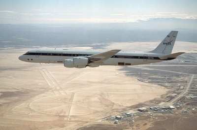
NASA DC-8
"Snow is notoriously hard to measure as it falls," said Walter
Petersen, the GPM ground validation scientist at NASA's Wallops
Flight Facility in Virginia. "Snowflakes contain varying amounts of
air and water, and they flutter, wobble and drift as they leave the
clouds." Knowing how "wet" a snowflake is allows scientists to
measure overall water content. A wet, heavy snow can shut down a
city, and melted snow is a crucial source of freshwater in many
areas.
Working with Environment Canada, NASA's GPM Cold-season
Precipitation Experiment (GCPEx) will measure light rain and snow
in Ontario from Jan. 17 to Feb. 29. The field campaign is designed
to improve satellite estimates of falling snow and test ground
validation capabilities in advance of the planned launch of the GPM
Core satellite in 2014.
NASA's DC-8 airborne science laboratory will fly out of Bangor,
ME, carrying radar and a radiometer that will simulate the
measurements to be taken from space by GPM. At an altitude of
33,000 feet (10 kilometers), the DC-8 will make multiple passes
over an extensive ground network of snow gauges and sensors at
Environment Canada's Center for Atmospheric Research Experiments
north of Toronto. The GCPEx field experiment will help scientists
match measurements of snow in the air and on the ground with the
satellite's measurements. "We will be looking at the precipitation
and the physics of precipitation, such as snowflake types, sizes,
shapes, numbers and water content," Petersen said. "These
properties affect both how we interpret and improve our
measurements."

GPM's Core satellite is being built at NASA's Goddard Space
Flight Center in Greenbelt, Md., with instruments provided by NASA
and its mission partner, the Japanese Aerospace and Exploration
Agency (JAXA). The spacecraft will orbit Earth at a 65-degree
inclination, covering the world from the Antarctic Circle to the
Arctic Circle. GPM will carry a microwave radiometer and a
dual-frequency precipitation radar that distinguishes a snowflake's
size and shape, which affects how much water it holds. Knowing
these microphysical properties will lead to more accurate estimates
of rain and snowfall, especially during winter and at high
latitudes where snow is the dominant form of precipitation.
The Ontario region is prone to both lake effect snow squalls and
widespread snowstorms. If the opportunity exists, the DC-8 also
will fly over blizzards along the northeastern United States. While
the DC-8 flies above the clouds, two other aircraft, one from the
University of North Dakota and another from Canada, will fly
through the clouds, measuring the microphysical properties of the
raindrops and snowflakes inside. Advanced ground radars will scan
the entire air column from the clouds to the Earth's surface.
"These multiple measurements of snowfall provide a complete
picture, a complete model, of the snowfall process from top to
bottom," Petersen said.
 Airbus Racer Helicopter Demonstrator First Flight Part of Clean Sky 2 Initiative

