Report: Global Aerial Imaging Market To Reach Nearly $2 Billion By 2019 | Aero-News Network
Aero-News Network
RSS icon RSS feed
podcast icon MP3 podcast
Subscribe Aero-News e-mail Newsletter Subscribe

Airborne Unlimited -- Most Recent Daily Episodes

Episode Date

Airborne-Monday

Airborne-Tuesday

Airborne-Wednesday Airborne-Thursday

Airborne-Friday

Airborne On YouTube

Airborne-Unlimited-04.29.24

Airborne-NextGen-04.30.24

Airborne-Unlimited-05.01.24 Airborne-AffordableFlyers--05.02.24

Airborne-Unlimited-05.03.24

Fri, Mar 07, 2014

Report: Global Aerial Imaging Market To Reach Nearly $2 Billion By 2019

Used For Natural Resource Management, Media, Construction And Development

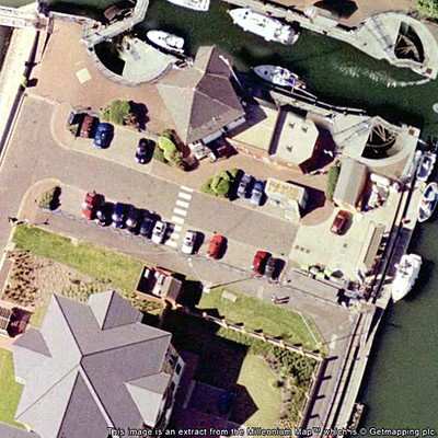
According to a new market report "Aerial Imaging Market - Global Industry Analysis, Size, Share, Growth, Trends, and Forecast, 2013 - 2019," published by Transparency Market Research, the market for aerial imaging globally is forecast to reach $1.994 billion by 2019. The market growth is driven by increased demand from applications such as natural resource management and construction & development. Real estate, urban planning and insurance are emerging as potential applications for aerial imagery and related services.

Globally, the aerial imaging market was valued at $869.2 million in 2012 and is forecast to grow at 12.8% CAGR (Compound Annual Growth Rate) from 2013 - 2019. Aerial imaging has been widely adopted across several end-use verticals such as commercial enterprises, government, civil engineering industry, forestry & agriculture, and energy sectors, among others. Among all, highest revenue share was contributed by the government sector in 2012, which together with commercial enterprises and forestry and agriculture, accounted for more than 50% of revenue share. Government organizations worldwide are progressively using aerial imagery and related services for numerous purposes such as homeland security, urban planning, energy sector management, and monitor environmental changes among others.

Aerial imagery and surveys are used for natural resources management, media & entertainment, construction & development, and 'conservation, research and study' among others. Construction & development, geospatial technology, and natural resource management are emerging as promising applications for aerial imaging industry. These three segments together accounted for 52.2% of market revenue share in 2012. Geographically, North America is expected to remain largest market for aerial imagery owing to the fast growing unmanned aerial vehicle (UAS) photography in this region. North America and Europe had collective revenue share of 80.1% in 2012.

(Image from file)

FMI: www.transparencymarketresearch.com

Advertisement

More News

ANN's Daily Aero-Term (05.01.24): Say Altitude

Say Altitude Used by ATC to ascertain an aircraft's specific altitude/flight level. When the aircraft is climbing or descending, the pilot should state the indicated altitude round>[...]

ANN's Daily Aero-Linx (05.01.24)

Aero Linx: European Air Law Association (EALA) EALA was established in 1988 with the aim to promote the study of European air law and to provide an open forum for those with an int>[...]

Classic Aero-TV: Korean War Hero Twice Reborn

From 2023 (YouTube Version): The Life, Death, Life, Death, and Life of a Glorious Warbird In 1981, business-owner Jim Tobul and his father purchased a Chance-Vought F4U Corsair. Mo>[...]

Airborne 04.29.24: EAA B-25 Rides, Textron 2024, G700 Deliveries

Also: USCG Retires MH-65 Dolphins, Irish Aviation Authority, NATCA Warns FAA, Diamond DA42 AD This summer, history enthusiasts will have a unique opportunity to experience World Wa>[...]

Airborne Affordable Flyers 05.02.24: Bobby Bailey, SPRG Report Cards, Skydive!

Also: WACO Kitchen Bails, French SportPlane Mfr to FL, Dynon-Advance Flight Systems, Innovation Preview Bobby Bailey, a bit of a fixture in sport aviation circles for his work with>[...]

blog comments powered by Disqus


Advertisement

Advertisement

Podcasts

Advertisement

© 2007 - 2024 Web Development & Design by Pauli Systems, LC