Scientific Citation Probes Perimeter Of Volcanic Ash Cloud | Aero-News Network
Aero-News Network
RSS icon RSS feed
podcast icon MP3 podcast
Subscribe Aero-News e-mail Newsletter Subscribe

Airborne Unlimited -- Most Recent Daily Episodes

Episode Date

Airborne-Monday

Airborne-Tuesday

Airborne-Wednesday Airborne-Thursday

Airborne-Friday

Airborne On YouTube

Airborne-Unlimited-05.06.24

Airborne-NextGen-05.07.24

Airborne-Unlimited-05.08.24 Airborne-FlightTraining-05.09.24

Airborne-Unlimited-05.10.24

Wed, Apr 21, 2010

Scientific Citation Probes Perimeter Of Volcanic Ash Cloud

NLR Research Aircraft Used To Verify Movement Of The Cloud

The National Aerospace Laboratory's (NLR) research aircraft has investigated the volcanic ash cloud hovering over the Netherlands. The purpose of this flight was to verify the accuracy of atmospheric models currently being used to predict the movements of the ash cloud.

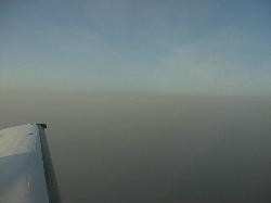
From the flight undertaken by the Cessna Citation on Sunday night above the Netherlands' southern provinces, it emerged that the ash cloud is highly visible. The edges of the ash cloud hovering above the country's southern provinces were also highly visible, which is crucial information for pilots when the air space is (temporarily) opened.

The objective of this flight was to verify the accuracy of the models the Royal Netherlands Meteorological Institute uses to calculate the movements of the volcanic ash cloud. These measurements are then used by the Dutch aviation authorities to take decisions regarding the closing and (re)opening of air space.

Sunday night's flight revealed that the models had accurately estimated the location of the volcanic ash layer. The NLR's research aircraft flew over the ash cloud, which at the time was hovering at a height of 1.8 miles and was comprised of varying thicknesses.


NLR Photo

There are very few methods currently available in Europe for precisely measuring and tracking volcanic ash. Moreover, there are no set regulations in place for determining which ash particle concentration levels necessitate the opening (or closing) of air space. NLR researchers are therefore currently working closely with other institutes, including the Royal Netherlands Meteorological Institute, the National Institute for Public Health and the Environment, the Dutch Ministry of Defence, the Ministry of Transport, Public Works and Water Management, and Eurocontrol. This joint research will determine the best methods for quickly and safely launching sensors and measuring instruments capable of accurately monitoring volcanic ash.

FMI: www.nlr.nl/smartsite.dws?l=en&id=8650, www.knmi.nl

Advertisement

More News

Airborne-Flight Training 05.09.24: ERAU at AIAA, LIFT Diamond Buy, Epic A&P

Also: Vertical Flight Society, NBAA Maintenance Conference, GA Honored, AMT Scholarship For the first time, students from Embry-Riddle’s Daytona Beach, Florida, campus took t>[...]

ANN's Daily Aero-Term (05.07.24): Hazardous Weather Information

Hazardous Weather Information Summary of significant meteorological information (SIGMET/WS), convective significant meteorological information (convective SIGMET/WST), urgent pilot>[...]

Aero-News: Quote of the Day (05.07.24)

"The need for innovation at speed and scale is greater than ever. The X-62A VISTA is a crucial platform in our efforts to develop, test and integrate AI, as well as to establish AI>[...]

NTSB Final Report: Cessna 150

(FAA) Inspector Observed That Both Fuel Tanks Were Intact And That Only A Minimal Amount Of Fuel Remained In Each Analysis: According to the pilot, approximately 8 miles from the d>[...]

Aero-News: Quote of the Day (05.08.24)

“Pyka’s Pelican Cargo is unlike any other UAS solution on the market for contested logistics. We assessed a number of leading capabilities and concluded that the Pelica>[...]

blog comments powered by Disqus


Advertisement

Advertisement

Podcasts

Advertisement

© 2007 - 2024 Web Development & Design by Pauli Systems, LC