Seattle Avionics Unveils Voyager 3.6 Flight Planning Software | Aero-News Network
Aero-News Network
RSS icon RSS feed
podcast icon MP3 podcast
Subscribe Aero-News e-mail Newsletter Subscribe

Airborne Unlimited -- Most Recent Daily Episodes

Episode Date

Airborne-Monday

Airborne-Tuesday

Airborne-Wednesday Airborne-Thursday

Airborne-Friday

Airborne On YouTube

Airborne-Unlimited-04.29.24

Airborne-Unlimited-04.23.24

Airborne-Unlimited-04.24.24 Airborne-FltTraining-04.25.24

Airborne-Unlimited-04.26.24

Wed, Jun 27, 2007

Seattle Avionics Unveils Voyager 3.6 Flight Planning Software

Includes Google Earth Interfaces, Routing Displays Fuel Prices

The folks at Seattle Avionics tell ANN they have taken the wraps off the latest iteration of its highly popular Voyager flight planning software. Voyager 3.6 is chocked full of new, pilot-pleasing features... including integration with Google Maps and Google Earth.

"Although not quite as highly anticipated as Apple's iPhone, new Voyager 3.6 is sure to make news with pilots," says Seattle Avionics CEO Steve Podradchik. "It has more than 50 very useful and exciting new features."

 
Listen To Steve Podradchik's Interview About Voyager 3.6 Here


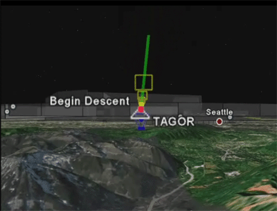
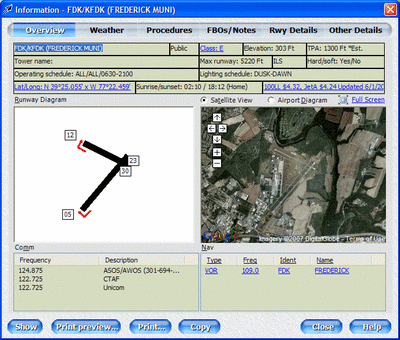
At the top of the list of features is the integration with Google Maps, which allows Voyager to show an actual satellite image of the airport you're flying to... invaluable for unfamiliar airports. You may also "fly" your entire route, aided by actual Google Earth images of terrain -- which should be a boon to VFR flyers, in particular.

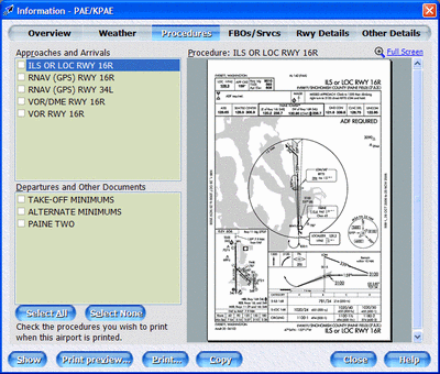
Voyager 3.6 also builds on the ability, first introduced on Voyager 3.5, to download true FAA scanned Charts. A new download manager on 3.6 allows pilots to download multiple charts, and the system queues them up automatically -- saving time, and memory space. You may also use the Monitor section to select which Charts you want Voyager to keep track of... and when they expire, automatically download current versions.

Additionally, by clicking on an airport on the chart -- or entering its identifier, name, or closest city -- Voyager shows you the most important flight information in one convenient screen. That includes runway diagrams, with markers for right-pattern approaches, a detailed airport diagram downloaded from the FAA, and Comm and Nav frequencies.

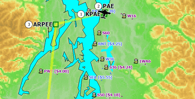
Voyager's autorouter now takes fuel prices into account when selecting stops... and Voyager even takes the additional fuel used to fly to cheap fuel airports into account when determining which airport is best. That is, it doesn't necessarily find the lowest fuel price, per se, it finds the best way to lower your total fuel cost. You can tell Voyager to only stop at airports with known fuel prices or stop at any airport that the AF/D says has fuel while giving preferences to airports with known fuel prices.

And speaking of fuel prices... they are everywhere in Voyager 3.6. Current prices -- downloaded from 100LL.com -- are listed visually on the charts, in the autorouter, in GlassView, and in printouts. Clicking on the price will also display cheaper prices in the same general area, if available.

Podradchik also tells ANN the company will host a free two-hour "webinar" this Friday, June 29, at 1200 PDT to cover everything that's new in Voyager 3.6. You may sign up here.

FMI: www.seattleavionics.com

Advertisement

More News

Unfortunate... ANN/SportPlane Resource Guide Adds To Cautionary Advisories

The Industry Continues to be Rocked By Some Questionable Operations Recent investigations and a great deal of data has resulted in ANN’s SportPlane Resource Guide’s rep>[...]

ANN FAQ: Turn On Post Notifications

Make Sure You NEVER Miss A New Story From Aero-News Network Do you ever feel like you never see posts from a certain person or page on Facebook or Instagram? Here’s how you c>[...]

ANN's Daily Aero-Term (04.29.24): Visual Approach Slope Indicator (VASI)

Visual Approach Slope Indicator (VASI) An airport lighting facility providing vertical visual approach slope guidance to aircraft during approach to landing by radiating a directio>[...]

ANN's Daily Aero-Term (04.28.24): Airport Marking Aids

Airport Marking Aids Markings used on runway and taxiway surfaces to identify a specific runway, a runway threshold, a centerline, a hold line, etc. A runway should be marked in ac>[...]

ANN's Daily Aero-Linx (04.28.24)

Aero Linx: The Skyhawk Association The Skyhawk Association is a non-profit organization founded by former Skyhawk Pilots which is open to anyone with an affinity for the A-4 Skyhaw>[...]

blog comments powered by Disqus


Advertisement

Advertisement

Podcasts

Advertisement

© 2007 - 2024 Web Development & Design by Pauli Systems, LC