North Dakota Uses BVLOS Test Network for Utility Recovery | Aero-News Network
Aero-News Network
RSS icon RSS feed
podcast icon MP3 podcast
Subscribe Aero-News e-mail Newsletter Subscribe

Airborne Unlimited -- Most Recent Daily Episodes

Episode Date

Airborne-Monday

Airborne-Tuesday

Airborne-Wednesday Airborne-Thursday

Airborne-Friday

Airborne On YouTube

Airborne-Unlimited-05.13.24

Airborne-NextGen-05.07.24

Airborne-Unlimited-05.08.24 Airborne-FlightTraining-05.09.24

Airborne-Unlimited-05.10.24

Sat, Apr 30, 2022

North Dakota Uses BVLOS Test Network for Utility Recovery

Harsh Weather Obtains Remote Inspection Services Using Vantis Network

The state's Northern Plains UAS Test Site (NPUASTS) has once again proven to be a fine investment, bringing a plethora of uncrewed aircraft operators into the state, perfectly poised to aid in case of emergency. 

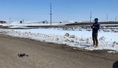
This week, a round of severe weather brought blizzards, heavy snow, and icing across western North Dakota, hampering emergency services and embattling public works with harsh conditions and overwork. Governor Doug Burgum announced a joint release with NPUASTS that they would enlist UAS operators to survey rural areas, locating and assessing damage to utility infrastructure in order to triage recovery efforts. 

The remotely piloted drones, flown by ISight Drone Services and the NPUASTS, are able to operate BVLOS flights as part of the state's creation and implementation of its unique UAS network, Vantis. The flights were cleared with the FAA before rolling out, allowing them to assist the North Dakota Association of Rural Electric Cooperatives. Their work in assessing and inspecting utilities is estimated to have brought expected downtime to days as opposed to the weeks that would be taken for on-site human inspection. 

“This is one of the primary applications we envisioned in creating this UAS network,” said Trevor Woods, NPUASTS executive director. “We hope this nimble response can help the state’s residents in getting life-saving power restored, and benefit areas and businesses affected by the natural disaster. For such a massive undertaking in fixing lines and infrastructure, we know that locating damage in difficult-to-travel-to areas saves time and assets that can’t afford to be wasted.” 

FMI: www.vantisuas.com

Advertisement

More News

Airborne 05.10.24: Icon Auction, Drunk MedEvac Pilot, Bell ALFA

Also: SkyReach Parts Support, Piper Service Ctr, Airliner Near-Miss, Airshow London The Judge overseeing Icon's convoluted Chapter 11 process has approved $9 million in Chapter 11 >[...]

ANN's Daily Aero-Term (05.13.24): ILS PRM Approach

ILS PRM Approach An instrument landing system (ILS) approach conducted to parallel runways whose extended centerlines are separated by less than 4,300 feet and at least 3,000 feet >[...]

ANN's Daily Aero-Linx (05.13.24)

Aero Linx: FlyPups FlyPups transports dogs from desperate situations to fosters, no-kill shelters, and fur-ever homes. We deliver trained dogs to veterans for service and companion>[...]

Airborne-NextGen 05.07.24: AI-Piloted F-16, AgEagle, 1st 2 WorldView Sats

Also: Skydio Chief, Uncle Sam Sues, Dash 7 magniX, OR UAS Accelerator US Secretary of the Air Force Frank Kendall was given a turn around the patch in the 'X-62A Variable In-flight>[...]

Airborne 05.08.24: Denali Update, Dad-Daughter Gyro, Lake SAIB

Also: NBAA on FAA Reauth, DJI AG Drones, HI Insurance Bill Defeated, SPSA Airtankers The Beechcraft Denali continues moving forward towards certification, having received its FAA T>[...]

blog comments powered by Disqus


Advertisement

Advertisement

Podcasts

Advertisement

© 2007 - 2024 Web Development & Design by Pauli Systems, LC