Florida Waits For Wilma | Aero-News Network
Aero-News Network
RSS icon RSS feed
podcast icon MP3 podcast
Subscribe Aero-News e-mail Newsletter Subscribe

Airborne Unlimited -- Most Recent Daily Episodes

Episode Date

Airborne-Monday

Airborne-Tuesday

Airborne-Wednesday Airborne-Thursday

Airborne-Friday

Airborne On YouTube

Airborne-Unlimited-05.13.24

Airborne-NextGen-05.07.24

Airborne-Unlimited-05.08.24 Airborne-FlightTraining-05.09.24

Airborne-Unlimited-05.10.24

Mon, Oct 24, 2005

Florida Waits For Wilma

Keys Evacuated, RSW Closed As Southern Florida Braces For Storm

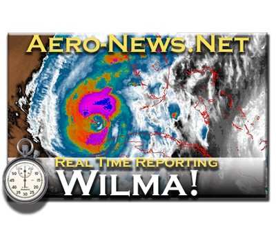
Hurricane Wilma -- which, barring a sudden and unexpected shift in direction, will be the seventh hurricane to hit Florida in the last 14 months -- is barrelling towards the southwestern coast of the state, and is expected to make landfall around 8 am Monday as a strong Category 2 or 3 storm.

The Florida Keys have been under an evacuation order since Friday, although some hearty souls vowed to weather the storm. Southwest Florida Regional Airport (RSW) in Fort Myers was expected to close Sunday night, and many carriers had already suspended operations. As of Sunday afternoon, few seats were available on commercial flights out of southern Florida -- mostly for First Class fares.

A hurricane warning has been issued for the Florida Keys, as well as for the east coast of the state from Titusville, southward and along the west coast from Longboat Key southward. Preliminary forecasts indicate the storm will hit in the area of Ten Thousand Islands, just south of Marco Island.

The speed of the storm has increased since moving out of Mexico's Yucatan Peninsula Sunday, after battering that region will torrential rains and winds in excess of 100 mph. Forecasters are predicting Wilma may have sustained winds as high as 130 mph when it hits Florida, according to Bloomberg News.

The state is expected to begin feeling the effects of the storm by Sunday night, even as the heart of the storm is as much as 200 miles away. Forecasters warn there may also be several tornadoes ahead of the storm, as the hurricane's warm, moist warm air makes contact with the cooler, drier air ahead of the front deflecting the storm towards Florida.

"The most important thing for people to do is follow the advice of local emergency workers," said Ed Rappaport, deputy director at the National Hurricane Center in Miami, in a televised news conference. "We are advising people to prepare for a Category 3."

Florida Governor Jeb Bush has also urged Florida residents to brace for the storm, as well as stating "heavy power outages" are expected in the area between Fort Myers, and the Florida Keys. Emergency officials in Florida advised residents and tourists in the southern part of the state to head north toward Orlando.

New York, Georgia, Mississippi, and Texas have contributed a portion of 24 Blackhawk and 10 Chinook helicopters standing ready for emergency service, Bush said.

Now, we wait...

FMI: www.nws.noaa.gov

Advertisement

More News

Sierra Space Repositions Dream Chaser for First Mission

With Testing Soon Complete, Launch Preparations Begin in Earnest Sierra Space's Dream Chaser has been put through the wringer at NASA's Glenn Armstrong Test Facility in Ohio, but w>[...]

ANN's Daily Aero-Term (05.10.24): Takeoff Roll

Takeoff Roll The process whereby an aircraft is aligned with the runway centerline and the aircraft is moving with the intent to take off. For helicopters, this pertains to the act>[...]

Aero-News: Quote of the Day (05.10.24)

“We’re proud of the hard work that went into receiving this validation, and it will be a welcome relief to our customers in the European Union. We couldn’t be mor>[...]

Aero-News: Quote of the Day (05.11.24)

"Aircraft Spruce is pleased to announce the acquisition of the parts distribution operations of Wag-Aero. Wag-Aero was founded in the 1960’s by Dick and Bobbie Wagner in the >[...]

ANN's Daily Aero-Term (05.11.24): IDENT Feature

IDENT Feature The special feature in the Air Traffic Control Radar Beacon System (ATCRBS) equipment. It is used to immediately distinguish one displayed beacon target from other be>[...]

blog comments powered by Disqus


Advertisement

Advertisement

Podcasts

Advertisement

© 2007 - 2024 Web Development & Design by Pauli Systems, LC