Sat, Sep 30, 2017
No-Drone-Zone Begins 400 Feet From The Lateral Boundaries Of The Sites
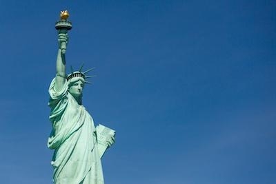
At the request of U.S. national security and law enforcement agencies, the Federal Aviation Administration (FAA) is using its existing authority under Title 14 of the Code of Federal Regulations (14 CFR) § 99.7 – “Special Security Instructions” – to address concerns about unauthorized drone operations over 10 Department of the Interior (DOI) sites, including the Statue of Liberty and Mount Rushmore.
This is the first time the agency has placed airspace restrictions for unmanned aircraft, or “drones,” over DOI landmarks. The FAA has placed similar airspace restrictions over military bases that currently remain in place.
The restrictions will be effective October 5, 2017. There are only a few exceptions that permit drone flights within these restrictions, and they must be coordinated with the individual facility and/or the FAA.
The FAA and DOI have agreed to restrict drone flights up to 400 feet within the lateral boundaries of these sites:
- Statue of Liberty National Monument, New York, NY
- Boston National Historical Park (U.S.S. Constitution), Boston, MA
- Independence National Historical Park, Philadelphia, PA
- Folsom Dam; Folsom, CA
- Glen Canyon Dam; Lake Powell, AZ
- Grand Coulee Dam; Grand Coulee, WA
- Hoover Dam; Boulder City, NV
- Jefferson National Expansion Memorial; St. Louis, MO
- Mount Rushmore National Memorial; Keystone, SD
- Shasta Dam; Shasta Lake, CA
To ensure the public is aware of these restricted locations, the FAA has created an interactive map online. The link to these restrictions is also included in the FAA’s B4UFLY mobile app. The app will be updated within 60 days to reflect these airspace restrictions. Additional information, including frequently asked questions, is available on the FAA’s UAS website.
Operators who violate the airspace restrictions may be subject to enforcement action, including potential civil penalties and criminal charges.
The FAA is considering additional requests from other federal agencies for restrictions using the FAA’s § 99.7 authority as they are received.
(Source: FAA news release. Image from file)
More News
From 2023 (YouTube Version): Legacy of a Titan Robert (Bob) Anderson Hoover was a fighter pilot, test pilot, flight instructor, and air show superstar. More so, Bob Hoover was an i>[...]
Get The Latest in Aviation News NOW on Instagram Are you on Instagram yet? It's been around for a few years, quietly picking up traction mostly thanks to everybody's new obsession >[...]
Aero Linx: B-52H Stratofortress The B-52H Stratofortress is a long-range, heavy bomber that can perform a variety of missions. The bomber is capable of flying at high subsonic spee>[...]
Altimeter Setting The barometric pressure reading used to adjust a pressure altimeter for variations in existing atmospheric pressure or to the standard altimeter setting (29.92).>[...]
"Knowing that we play an active part in bettering people's lives is extremely rewarding. My team and I are very thankful for the opportunity to be here and to help in any way we ca>[...]
 Classic Aero-TV: Remembering Bob Hoover

