Remote GeoSystems Partners With Purdue University On Drone Degree Program | Aero-News Network
Aero-News Network
RSS icon RSS feed
podcast icon MP3 podcast
Subscribe Aero-News e-mail Newsletter Subscribe

Airborne Unlimited -- Most Recent Daily Episodes

Episode Date

Airborne-Monday

Airborne-Tuesday

Airborne-Wednesday Airborne-Thursday

Airborne-Friday

Airborne On YouTube

Airborne-Unlimited-05.13.24

Airborne-NextGen-05.07.24

Airborne-Unlimited-05.08.24 Airborne-FlightTraining-05.09.24

Airborne-Unlimited-05.10.24

Mon, Feb 18, 2019

Remote GeoSystems Partners With Purdue University On Drone Degree Program

Provides $111,000 Video-Mapping Software Donation

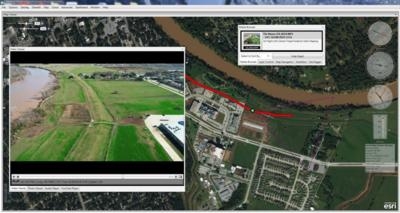
Remote GeoSystems, Inc., a provider of immersive geospatial video, photo and data recording and reporting software for survey and inspection, is partnering with Purdue University with a gift to the Unmanned Aerial Systems (UAS) degree program and laboratory. The UAS program at Purdue focuses on geospatial data collection and analysis by unmanned aerial systems.

As part of the partnership, Remote GeoSystems is providing Purdue with a starting gift of the company’s LineVision video-mapping software suite valued at $111,000, with additional licenses available as needed by students and faculty. Purdue will support Remote GeoSystems as a research and development partner by beta testing new features and technologies and exploring an ever-growing array of applications for Remote GeoSystems’ geospatial software and hardware within the research community.

“Remote GeoSystems is on the leading edge of videogrammetry,” says Joseph Hupy, Ph.D., associate professor with Purdue University’s School of Aviation and Transportation Technology.

Videogrammetry refers to utilizing specific methods and software capabilities for rapidly collecting continuously geo-referenced video and then “geo-editing” and extracting geotagged still photos from the video at user-defined frequencies. These video-derived image datasets are then used to build orthomosaics and 3D models in traditional geospatial imagery processing software.

“Remote GeoSystems is establishing methods to quickly collect and derive the geospatial data from drone videos that will change a number of industries and drive the acceleration of location-based artificial intelligence,” explained Hupy. “Having their software and team connected to Purdue is a significant resource for our evolving UAS program.”

The School of Aviation and Transportation Technology – part of Purdue Polytechnic Institute, one of the 10 academic colleges at Purdue University – is based out of the historic Niswonger Aviation Technology Building, which once housed Amelia Earhart’s airplane.

“Purdue has long been a global leader in aerospace and engineering curriculum and a pioneering institution in the aviation field since the early 20th century,” says Jeff Dahlke, managing director, Remote GeoSystems. “We are proud to now partner with and support the University as their next generation of students takes UAS platforms from novelty to the true airborne workhorses of the 21st century.”

(Image provided with Remote GeoSystems news release)

FMI: www.remotegeo.com

Advertisement

More News

Sierra Space Repositions Dream Chaser for First Mission

With Testing Soon Complete, Launch Preparations Begin in Earnest Sierra Space's Dream Chaser has been put through the wringer at NASA's Glenn Armstrong Test Facility in Ohio, but w>[...]

ANN's Daily Aero-Term (05.10.24): Takeoff Roll

Takeoff Roll The process whereby an aircraft is aligned with the runway centerline and the aircraft is moving with the intent to take off. For helicopters, this pertains to the act>[...]

Aero-News: Quote of the Day (05.10.24)

“We’re proud of the hard work that went into receiving this validation, and it will be a welcome relief to our customers in the European Union. We couldn’t be mor>[...]

Aero-News: Quote of the Day (05.11.24)

"Aircraft Spruce is pleased to announce the acquisition of the parts distribution operations of Wag-Aero. Wag-Aero was founded in the 1960’s by Dick and Bobbie Wagner in the >[...]

ANN's Daily Aero-Term (05.11.24): IDENT Feature

IDENT Feature The special feature in the Air Traffic Control Radar Beacon System (ATCRBS) equipment. It is used to immediately distinguish one displayed beacon target from other be>[...]

blog comments powered by Disqus


Advertisement

Advertisement

Podcasts

Advertisement

© 2007 - 2024 Web Development & Design by Pauli Systems, LC