Harris Corporation Helps Alaskan Pilots With Flight Planning | Aero-News Network
Aero-News Network
RSS icon RSS feed
podcast icon MP3 podcast
Subscribe Aero-News e-mail Newsletter Subscribe

Airborne Unlimited -- Most Recent Daily Episodes

Episode Date

Airborne-Monday

Airborne-Tuesday

Airborne-Wednesday Airborne-Thursday

Airborne-Friday

Airborne On YouTube

Airborne-Unlimited-04.29.24

Airborne-Unlimited-04.23.24

Airborne-Unlimited-04.24.24 Airborne-FltTraining-04.25.24

Airborne-Unlimited-04.26.24

Mon, Oct 29, 2007

Harris Corporation Helps Alaskan Pilots With Flight Planning

Provides Real-Time Weather, Flight Data

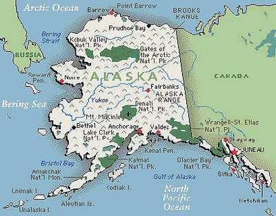
Aero-News has learned Alaskan air traffic controllers are now using integrated weather briefing and flight planning technology developed by Harris Corporation to assist General Aviation pilots with flight planning. The system is operational at 17 Flight Service Stations and Automated Flight Service Stations across the state.

The announcement was made at the 52nd Annual Air Traffic Control Association (ATCA) Conference and Exposition being held October 28-31, 2007, at the Marriott Wardman Park Hotel in Washington, DC.

The Harris Operational and Supportability Implementation System (OASIS) integrates real-time weather and flight planning data through a PC-based system that overlays flight routes onto up-to-the-minute weather graphics and processes and displays alphanumeric weather and flight data. The system processes "Notice to Airmen" messages and supplies current radar, satellite imagery, and lightning data. OASIS also provides transmission and receipt of messages to support Search and Rescue operations.

"OASIS provides the types of real-time information that are critical to general aviation pilots in their flight planning activities," said Cheryl Janey, president of Harris Civil Programs. "The quick implementation of the Alaska OASIS system within a six-month period reflects the strong cooperation between the Harris team and the Federal Aviation Administration (FAA)."

Harris has a long history of developing and integrating system solutions for the FAA in support of the National Airspace System. The company is the prime contractor for the FAA Telecommunications Infrastructure program, which is providing improved network security and communications services to more than 4,000 FAA facilities nationwide, providing the FAA with a more secure and efficient network that is expected to save $600 million over the life of the program.

Other FAA programs developed by Harris include the Weather And Radar Processor, a weather system serving the en-route air traffic control environment; the Voice Switching and Control System, which provides critical air-to-ground communications links between en-route aircraft and air traffic controllers throughout the continental United States; and the satellite-based Alaskan NAS Interfacility Communications System.

The Harris Civil Programs business provides precise, highly reliable, high-speed communications and information networks that improve productivity and information processing for federal agencies of the US government, including the FAA, Census Bureau, National Oceanic and Atmospheric Administration, Department of Justice, and Government Printing Office.

FMI: www.harris.com, www.faa.gov

Advertisement

More News

Unfortunate... ANN/SportPlane Resource Guide Adds To Cautionary Advisories

The Industry Continues to be Rocked By Some Questionable Operations Recent investigations and a great deal of data has resulted in ANN’s SportPlane Resource Guide’s rep>[...]

ANN FAQ: Turn On Post Notifications

Make Sure You NEVER Miss A New Story From Aero-News Network Do you ever feel like you never see posts from a certain person or page on Facebook or Instagram? Here’s how you c>[...]

ANN's Daily Aero-Term (04.29.24): Visual Approach Slope Indicator (VASI)

Visual Approach Slope Indicator (VASI) An airport lighting facility providing vertical visual approach slope guidance to aircraft during approach to landing by radiating a directio>[...]

ANN's Daily Aero-Term (04.28.24): Airport Marking Aids

Airport Marking Aids Markings used on runway and taxiway surfaces to identify a specific runway, a runway threshold, a centerline, a hold line, etc. A runway should be marked in ac>[...]

ANN's Daily Aero-Linx (04.28.24)

Aero Linx: The Skyhawk Association The Skyhawk Association is a non-profit organization founded by former Skyhawk Pilots which is open to anyone with an affinity for the A-4 Skyhaw>[...]

blog comments powered by Disqus


Advertisement

Advertisement

Podcasts

Advertisement

© 2007 - 2024 Web Development & Design by Pauli Systems, LC