Product To Offer Accurate, Simple, End-To-End Drone Data Workflow
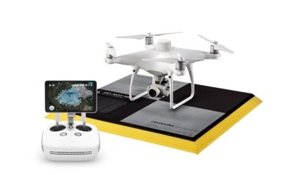
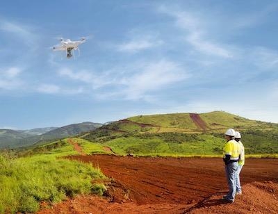
Propeller, a cloud-based drone analytics company, today announced a partnership with DJI, the world's leader in civilian drones and aerial imaging technology, to create the Propeller PPK Solution leveraging the DJI Phantom 4 RTK drone. This solution provides customers in the civil, mining, aggregates, and waste management industries with a reliable and fully integrated drone mapping system, helping them collect highly accurate data from any worksite, without the challenges of traditional workflows.

The Propeller PPK Solution is a fully integrated software and hardware system that reliably provides photogrammetric model outputs in geodetic, projected, or local coordinate systems. This solution provides accuracy of 1/10ft from independent checkpoints across small and large survey areas (checkpoints up to 1km from GCPs). To capture surveys of this accuracy, all that is needed is one AeroPoint on the ground (over a known point if working in local coordinates). The Propeller PPK Solution has been shown to reduce the time required to complete a drone survey by 70% as compared to a traditional workflow using multiple GCPs across a worksite.
"DJI has led the drone market with their reliable and innovative products, and quickly demonstrated the ability for these machines to become useful tools in the heavy civil and natural resource industries," said Rory San Miguel, CEO of Propeller Aero. "Globally, these industries are seeing real cost savings and efficiencies through cloud-based analytics and using innovative new technologies like PPK drones combined with AeroPoints. Accurate data is paramount to worksite analytics and Propeller has always been obsessed with helping teams achieve this. We introduced the world's first smart ground control point, AeroPoints, and now we've partnered up with DJI to build an end-to-end PPK solution."
On today's construction sites, lack of project data costs businesses more than $177B annually. To help solve this problem, Propeller developed a tightly integrated PPK workflow across the DJI Phantom 4 RTK drone, an AeroPoint, and Propeller's cloud processing platform that visualizes real-time site data. Surveyors and contractors across construction, mining, aggregates, and waste management industries are leveraging the Propeller PPK solution to gather verifiable, trustworthy data to help make data-driven decisions and prevent costly mistakes.

"Propeller's deep expertise in aerial mapping and analytics coupled with DJI's industry-leading open-platform drone hardware creates a highly accurate turnkey solution," said Jan Gasparic, Director of Strategic Partnerships at DJI. "We are excited about this partnership because it broadens the use of DJI drones to deliver accurate data at a cost-efficient price point, helping teams better answer questions about site progress and productivity."
The complete PPK solution will be distributed through channel partners, including Trimble's SITECH distribution network. Trimble Stratus, a 3D cloud-based visualization platform developed by Propeller, along with AeroPoints, is already integrated with Trimble Connected Site solutions.
"The advent of drones in the construction industry has improved efficiencies, and Trimble Stratus users are already benefiting from the ease-of-use and scalability of drone-based surveys," said Scott Crozier, general manager, Trimble Civil Engineering and Construction. "With the new Propeller PPK Solution and Trimble Stratus software, we've seen first-hand how surveyors and contractors can collect aerial survey data in a fraction of the time it used to take, and get repeatable and reliable results."
(Image provided with Propeller news release)
 ANN's Daily Aero-Term (04.26.24): DETRESFA (Distress Phrase)
 ANN's Daily Aero-Linx (04.26.24)
 Airborne 04.22.24: Rotor X Worsens, Airport Fees 4 FNB?, USMC Drone Pilot
 Airborne 04.24.24: INTEGRAL E, Elixir USA, M700 RVSM
 Airborne-NextGen 04.23.24: UAVOS UVH 170, magni650 Engine, World eVTOL Directory


