Wed, Apr 12, 2017
Will Depict Areas And Altitudes Near Airports Where Drones May Operate Safely
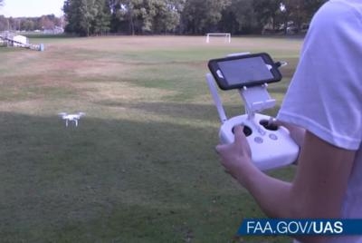
The FAA plans to release the first set of unmanned aircraft systems (UAS) facility maps on April 27. The maps will depict areas and altitudes near airports where UAS may operate safely. They will help drone operators improve the quality of their Part 107 airspace authorization requests, which will help the FAA process these requests more quickly.
Beginning April 27, users may access the facility maps online. Users will be able to download the data in several formats, view the site on mobile devices, and customize their views.
By referring to the facility maps when completing airspace authorization applications, remote pilots will be able to tailor their requests to align with locations and altitudes that the maps indicate are likely to be approved for small UAS operations. This will help simplify the process and increase the likelihood that the FAA will approve their requests.
FAA air traffic personnel will use the maps to process Part 107 airspace authorization requests. Altitudes that exceed what are depicted on the maps require additional safety analysis and coordination to determine if an application can be approved.
The maps will be informational only. They do not automatically authorize flights. Remote pilots must still submit online airspace authorization applications.The maps also do not guarantee approval for requests within the guidelines indicated by the maps. Only the FAA can grant controlled airspace access, which must be done through the authorization process.
The agency is releasing the maps in phases, with the first release on April 27 containing approximately 200 facility maps. The FAA plans to release facility maps over the next 12 months. Updates to the maps database will coincide with the agency’s existing 56-day aeronautical chart production schedule (PDF). If a map is not yet available, it can be expected in future releases.
(Source: FAA news release. Image from file)
More News
Aero Linx: Model Aeronautical Association of Australia MAAA clubs are about fun flying, camaraderie and community. For over 75 years, the MAAA has been Australia’s largest fl>[...]
Touchdown Zone Lighting Two rows of transverse light bars located symmetrically about the runway centerline normally at 100 foot intervals. The basic system extends 3,000 feet alon>[...]
“Discovery and innovation are central to our mission at Virgin Galactic. We’re excited to build on our successful record of facilitating scientific experiments in subor>[...]
How To Get A Story On Aero-TV News/Feature Programming How do I submit a story idea or lead to Aero-TV? If you would like to submit a story idea or lead, please contact Jim Campbel>[...]
Student Pilot Reported That During Rotation, “All Of A Sudden The Back Of The Plane Kicked To The Right..." Analysis: The student pilot reported that during rotation, “>[...]
 ANN's Daily Aero-Linx (05.02.24)

