FAA Restricts Drone Operations Over Certain DOE Facilities | Aero-News Network
Aero-News Network
RSS icon RSS feed
podcast icon MP3 podcast
Subscribe Aero-News e-mail Newsletter Subscribe

Airborne Unlimited -- Most Recent Daily Episodes

Episode Date

Airborne-Monday

Airborne-Tuesday

Airborne-Wednesday Airborne-Thursday

Airborne-Friday

Airborne On YouTube

Airborne-Unlimited-04.29.24

Airborne-NextGen-04.30.24

Airborne-Unlimited-05.01.24 Airborne-AffordableFlyers--05.02.24

Airborne-Unlimited-05.03.24

Wed, Dec 20, 2017

FAA Restricts Drone Operations Over Certain DOE Facilities

NOTAM Issued For Seven Locations Around The Country

At the request of U.S. national security and law enforcement agencies, the FAA is using its existing authority under Title 14 of the Code of Federal Regulations § 99.7 – “Special Security Instructions” – to address concerns about unauthorized drone operations over seven Department of Energy (DOE) facilities.

The FAA and DOE have agreed to restrict drone flights up to 400 feet within the lateral boundaries of these sites:

- Hanford Site, Franklin County, WA
- Pantex Site, Panhandle, TX
- Los Alamos National Laboratory, Los Alamos, NM
- Idaho National Laboratory, Idaho Falls, ID
- Savannah River National Laboratory, Aiken, SC
- Y-12 National Security Site, Oak Ridge, TN
- Oak Ridge National Laboratory, Oak Ridge, TN

These UAS National Security restrictions are pending until they become effective on December 29, 2017. There are only a few exceptions that permit drone flights within these restrictions, and they must be coordinated with the individual facility and/or the FAA.

To ensure the public is aware of these restricted locations, the FAA has created an interactive map online. The link to these restrictions is also included in the FAA’s B4UFLYmobile app. The app will be updated within 60 days to reflect these airspace restrictions. Additional information, including frequently asked questions, is available on the FAA’s UAS website.

Operators who violate the airspace restrictions may be subject to enforcement action, including potential civil penalties and criminal charges.

This is the first time the agency has placed specific airspace restrictions for unmanned aircraft, or “drones,” over DOE sites. The FAA has placed similar airspace restrictions over military bases that currently remain in place, as well as more recently issued UAS flight restrictions over 10 Department of Interior facilities, including several large dams and iconic landmarks.

The FAA is considering additional requests from other federal security agencies for restrictions using the FAA’s § 99.7 authority to support national security and defense, as they are received.

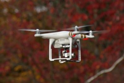
(Source: FAA news release. Image from file)

FMI: uas-faa.opendata.arcgis.com

Advertisement

More News

ANN's Daily Aero-Linx (05.02.24)

Aero Linx: Model Aeronautical Association of Australia MAAA clubs are about fun flying, camaraderie and community. For over 75 years, the MAAA has been Australia’s largest fl>[...]

ANN's Daily Aero-Term (05.02.24): Touchdown Zone Lighting

Touchdown Zone Lighting Two rows of transverse light bars located symmetrically about the runway centerline normally at 100 foot intervals. The basic system extends 3,000 feet alon>[...]

Aero-News: Quote of the Day (05.02.24)

“Discovery and innovation are central to our mission at Virgin Galactic. We’re excited to build on our successful record of facilitating scientific experiments in subor>[...]

ANN FAQ: Contributing To Aero-TV

How To Get A Story On Aero-TV News/Feature Programming How do I submit a story idea or lead to Aero-TV? If you would like to submit a story idea or lead, please contact Jim Campbel>[...]

NTSB Final Report: Cirrus Design Corp SR20

Student Pilot Reported That During Rotation, “All Of A Sudden The Back Of The Plane Kicked To The Right..." Analysis: The student pilot reported that during rotation, “>[...]

blog comments powered by Disqus


Advertisement

Advertisement

Podcasts

Advertisement

© 2007 - 2024 Web Development & Design by Pauli Systems, LC