USAF Hurricane Hunters Tracked Sally | Aero-News Network
Aero-News Network
RSS icon RSS feed
podcast icon MP3 podcast
Subscribe Aero-News e-mail Newsletter Subscribe

Airborne Unlimited -- Most Recent Daily Episodes

Episode Date

Airborne-Monday

Airborne-Tuesday

Airborne-Wednesday Airborne-Thursday

Airborne-Friday

Airborne On YouTube

Airborne-Unlimited-04.29.24

Airborne-NextGen-04.30.24

Airborne-Unlimited-05.01.24 Airborne-AffordableFlyers--05.02.24

Airborne-Unlimited-05.03.24

Sat, Sep 19, 2020

USAF Hurricane Hunters Tracked Sally

Members Of The 53rd WRS Made Multiple Flights Into Hurricane Sally

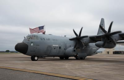
The 53rd Weather Reconnaissance Squadron “Hurricane Hunters,” flew nine missions into Hurricane Sally to track the storm and gather data.

The 53rd WRS, an Air Force Reserve unit assigned to the 403rd Wing, started flying missions into then-Tropical Storm Sally from their home station, Keesler Air Force Base, Mississippi, Sept. 11, said Maj. Grant Wagner, a 53rd WRS navigator and mission commander.

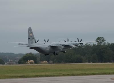
As the storm headed toward the coast of Mississippi, the 403rd Wing evacuated their planes to another base and relocated three WC-130J Super Hercules aircraft to Ellington Airport, Texas to continue flying missions into Sally.

During their flight late Sept. 13, the tropical storm was upgraded to a hurricane. As a Category 1 hurricane, forecasters were still uncertain of how much Sally would strengthen.

“The eye of the storm struggled to remain stable, but had category 1 winds,” said Capt. Melissa Templeton, 53rd WRS aerial reconnaissance weather officer.

The Hurricane Hunters continued to fly missions into the storm to give the National Hurricane Center data for their forecast models using dropsondes.

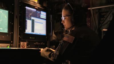
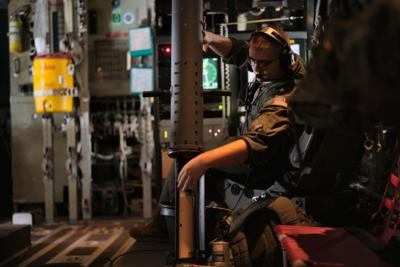
“Dropsondes are weather data-collection devices that are released from the aircraft into the storm,” said Senior Airman Donny Arseneaux, a 53rd WRS loadmaster. “We deploy multiple ‘sondes’ to collect weather data, such as wind speed, air pressure, temperature, and humidity.”

This data is sent back to the loadmaster’s computer on the aircraft, and they send it to the weather officer for review before it is transmitted to the NHC to be used in updating the forecast models of the storm.

Over the course of six days, the aircrews tracked Hurricane Sally until it made landfall as a Category 2 storm near Gulf Shores, Alabama, Sept. 16. After weakening back down to a tropical storm, it continued moving in a northeast direction.

Out of the storm’s path, the aircraft were relocated back to Keesler AFB Sept. 17 to their mission of tracking future storms.

FMI: www.af.mil, www.403wg.afrc.af.mil


Advertisement

More News

ANN's Daily Aero-Linx (05.02.24)

Aero Linx: Model Aeronautical Association of Australia MAAA clubs are about fun flying, camaraderie and community. For over 75 years, the MAAA has been Australia’s largest fl>[...]

ANN's Daily Aero-Term (05.02.24): Touchdown Zone Lighting

Touchdown Zone Lighting Two rows of transverse light bars located symmetrically about the runway centerline normally at 100 foot intervals. The basic system extends 3,000 feet alon>[...]

Aero-News: Quote of the Day (05.02.24)

“Discovery and innovation are central to our mission at Virgin Galactic. We’re excited to build on our successful record of facilitating scientific experiments in subor>[...]

ANN FAQ: Contributing To Aero-TV

How To Get A Story On Aero-TV News/Feature Programming How do I submit a story idea or lead to Aero-TV? If you would like to submit a story idea or lead, please contact Jim Campbel>[...]

NTSB Final Report: Cirrus Design Corp SR20

Student Pilot Reported That During Rotation, “All Of A Sudden The Back Of The Plane Kicked To The Right..." Analysis: The student pilot reported that during rotation, “>[...]

blog comments powered by Disqus


Advertisement

Advertisement

Podcasts

Advertisement

© 2007 - 2024 Web Development & Design by Pauli Systems, LC