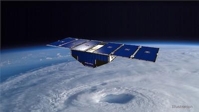
CYGNSS Fleet Was Launched In 2016
Eight briefcase-size satellites flying in a row may be key to improving forecasts of a hurricane's wind speed - detecting whether it will make landfall as a Category 1 or a Category 5. NASA's Cyclone Global Navigation Satellite System (CYGNSS) fleet, launched in 2016, was designed to show whether the same GPS signals your phone uses for navigation can be used to measure winds deep within a hurricane or typhoon. The answer appears to be a resounding yes.