Next Phase Of Battlefield Surveillance And Recon System To Be
Tested
US forces operating in Iraq, Afghanistan and elsewhere may soon
be able to use "MAJIIC" to locate an enemy position on the
battlefield and share intelligence information and imagery with
coalition allies in near-real time.

And it all might be possible from a secure Web site.
In September, the Defense Department will test the next phase of
MAJIIC -- which stands for Multisensor Aerospace-Ground Joint ISR
(intelligence, surveillance and reconnaissance) Interoperability
Coalition Architecture -- during an advanced-concept technology
demonstration.
Joint Forces Command, based in Norfolk, VA, is the operational
manager for the project, which is taking place at Fort Huachuca,
AZ; at New Mexico State University at Las Cruces; and at the
command's headquarters.
"It's all about a single-point query to get at all of the ISR
information that's available based on location, time, status of the
ISR," said Navy Capt. Allan Nadolski, director for intelligence at
US Joint Forces Command. He was speaking at the C4ISR Integration
Conference here May 18.
C4ISR is an acronym for Command, Control, Communications,
Computer, Intelligence, Surveillance and Reconnaissance. The theme
of this year's conference is "Actionable Intelligence for the War
Fighter and Decision Maker."
"(MAJIIC) uses a Web-services approach, ... and it gets you away
from having to get to different Web sites to go and have to find
information and pull them together yourself," Nadolski said. "It
really is all about pulling all the information together first,
getting it on a network, and then being able to query that all at
one time."
The Defense Department is hopeful the new capability, which went
through its first validation in August 2004, will allow ISR
information to be shared among coalition partners and alleviate
massive data backlogs generated during operations.
Such was the case during Operation Iraqi Freedom. Nadolski said
ISR was in great demand, but because of the "huge volume of data,
analysis and dissemination of ISR data lagged behind military
operations that were very accelerated."
One of the demonstration's goals is to make ISR data available
to the customers who need it right away, he said.
The demonstration, he said, will be "heavily focused" on joint
and coalition ISR interoperability and data accessibility and will
enhance "battle-space awareness" and provide ISR support to
"time-sensitive operations and combat assessment."
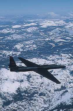
Nadolski said MAJIIC will use a variety of sensors to transport
information.
 During the demonstration, JFCOM will
develop concepts of operation and tactics, techniques and
procedures for coalition ISR operations, and demonstrate enhanced
ISR interoperability between coalition ISR systems.
During the demonstration, JFCOM will
develop concepts of operation and tactics, techniques and
procedures for coalition ISR operations, and demonstrate enhanced
ISR interoperability between coalition ISR systems.
The demonstration also will provide an enhanced ISR exploitation
and display of multinational data in support of a common coalition
operational picture and enable US and coalition partners to share
ISR data to support time-sensitive operations in a "netcentric"
environment.
Allied countries collaborating in the MAJIIC project include the
United Kingdom, France, Germany, Norway, Canada, Italy, the
Netherlands, and Spain, as well as the NATO Consultation, Command
and Control Agency. However, he added, those countries will not
take part in the demonstration.
"Networking the information and making it available across the
different domains, including the coalition-sharing piece, is going
to be a critical part of our focus," Nadolski said.
"We have to make the data accessible; it can't be done in a
vacuum," he said. "As my boss would say, 'We have to blur the lines
between operations and intelligence.'
"It really is all about making the information broadly available
and integrating it with the operation," he added.
Nadolski said a separate technology demonstration will link
MAJIIC with another project called the Adaptive Joint C4ISR
Node.
That effort will integrate the two platforms in an effort to
pass information from the joint task force headquarters down to the
brigade level and then to troops out on combat patrols.
The Defense Department plans to have these capabilities, MAJIIC
and AJCN, in place by 2008, Nadolski said.
(ANN salutes Sgt. 1st Class Doug Sample, USA)
 ANN's Daily Aero-Linx (04.15.24)

