Jeppesen Provides A Better Picture Of Hazardous Weather With New Lightning Maps | Aero-News Network
Aero-News Network
RSS icon RSS feed
podcast icon MP3 podcast
Subscribe Aero-News e-mail Newsletter Subscribe

Airborne Unlimited -- Most Recent Daily Episodes

Episode Date

Airborne-Monday

Airborne-Tuesday

Airborne-Wednesday Airborne-Thursday

Airborne-Friday

Airborne On YouTube

Airborne-Unlimited-04.01.24

Airborne-Unlimited-04.16.24

Airborne-FlightTraining-04.17.24 Airborne-Unlimited-04.11.24

Airborne-Unlimited-04.12.24

Join Us At 0900ET, Friday, 4/10, for the LIVE Morning Brief.
Watch It LIVE at
www.airborne-live.net

Tue, Jul 19, 2005

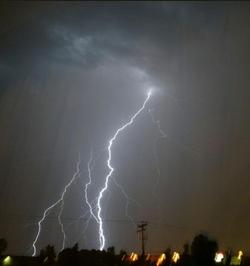
Jeppesen Provides A Better Picture Of Hazardous Weather With New Lightning Maps

I Can See Clearly Now...

Jeppesen says it's recently started adding lightning weather maps to its lineup of weather products. The lightning data is provided by the US Precision Lightning Network (USPLN), a partnership between TOA Systems and Weather Decisions Technologies (WDT). TOA Systems designed, built and installed the lightning sensors, and WDT distributes the data and provides applications that display the data.

New technology allows the detection of both cloud-to-ground lightning as well as lightning within clouds. Cloud-to-cloud lightning data is highly pertinent to pilots and dispatchers—typically more than 70 percent of all lightning strikes happen within clouds. Before Jeppesen began offering these new weather maps, only cloud-to-ground lightning data was available. By utilizing the latest technologies, Jeppesen is now able to provide a more complete lightning picture to its customers. The new lightning charts rely on 90 sensors across the United States that regularly detect lightning strikes as far away as northern Canada, the Caribbean, Mexico, Latin America, northern South America and the eastern Pacific out to Hawaii.

Jeppesen will offer USPLN lightning data as separate maps that are updated every 10-15 minutes as well as lightning data with infrared and visible satellite images. In areas outside of the NEXRAD radar network, lightning data is the best way to determine if convective activity and thunderstorms are present. The display software allows Jeppesen to show past lightning strikes as well as current strikes, so users can see trends in the activity. This is helpful in determining if a thunderstorm is growing or decaying and showing the movement of the active cells.

"The addition of the USPLN lightning data to Jeppesen's weather products is another step in providing the best aviation weather information to our customers," said Mike Cetinich, product manager. "With the recent additions of a NEXRAD forecast product, worldwide turbulence and icing maps, and now the USPLN lightning data, Jeppesen is at the forefront of state-of-the-art aviation weather products. We are committed and solely focused on aviation weather products that add value for the customer, and help them make more informed decisions."

FMI: www.jeppesen.com

Advertisement

More News

ANN's Daily Aero-Linx (04.15.24)

Aero Linx: International Flying Farmers IFF is a not-for-profit organization started in 1944 by farmers who were also private pilots. We have members all across the United States a>[...]

Classic Aero-TV: 'No Other Options' -- The Israeli Air Force's Danny Shapira

From 2017 (YouTube Version): Remembrances Of An Israeli Air Force Test Pilot Early in 2016, ANN contributor Maxine Scheer traveled to Israel, where she had the opportunity to sit d>[...]

Aero-News: Quote of the Day (04.15.24)

"We renegotiated what our debt restructuring is on a lot of our debts, mostly with the family. Those debts are going to be converted into equity..." Source: Excerpts from a short v>[...]

Airborne 04.16.24: RV Update, Affordable Flying Expo, Diamond Lil

Also: B-29 Superfortress Reunion, FAA Wants Controllers, Spirit Airlines Pulls Back, Gogo Galileo Van's Aircraft posted a short video recapping the goings-on around their reorganiz>[...]

ANN's Daily Aero-Term (04.16.24): Chart Supplement US

Chart Supplement US A flight information publication designed for use with appropriate IFR or VFR charts which contains data on all airports, seaplane bases, and heliports open to >[...]

blog comments powered by Disqus


Advertisement

Advertisement

Podcasts

Advertisement

© 2007 - 2024 Web Development & Design by Pauli Systems, LC