Marginal VFR Conditions Prevailed At The Time Of The Accident
The NTSB has released the factual report from an accident involving a de Havilland DHC 3 Otter floatplane on a charter flight in Alaska in July.
According to the report, on July 10, 2018, about 0835 Alaska daylight time, the airplane impacted rocky, mountainous, rising terrain about 9 miles east of Hydaburg, Alaska. Of the 11 occupants on board, the airline transport pilot was uninjured, four passengers sustained minor injuries, and six passengers sustained serious injuries. The airplane was registered to Blue Aircraft, LLC, and was operated by Taquan Air as an on-demand commercial flight. Marginal visual meteorological conditions prevailed for the visual flight rules (VFR) flight, and company flight following procedures were in effect. The flight departed Steamboat Bay about 0747 destined for Ketchikan, Alaska.
The purpose of the flight was to transport guests that were staying at the Steamboat Bay Fishing Club on Noyes Island back to Ketchikan. The area between Noyes Island and Ketchikan consists of remote inland fjords, coastal waterways, and steep mountainous terrain. A review of GPS data extracted from the Chelton Integrated Display Unit (IDU) revealed that after departing Steamboat Bay the flight proceeded easterly towards the village of Klawock and to the northwest edge of Klawock Lake, prior to making about a 270° turn, it then continued on a southerly heading along the west coast of Prince of Wales Island towards Waterfall Seaplane Base (KWF) prior to turning easterly towards Hydaburg and an area known as Sulzer Portage.
According to the pilot, while in level cruise flight about 1,100 ft mean sea level (msl) as the flight progressed into an area known as Sulzer Portage, visibility decreased rapidly in heavy rain and clouds. In an attempt to turn around and return to VFR conditions, he initiated a climbing right turn. Before completing the 180° right turn, he saw what he believed to be a body of water, and he became momentarily disoriented so he leveled the wings. Shortly thereafter, he realized that the airplane was approaching an area of snow-covered mountainous terrain, so he applied full power and initiated a steep climb to avoid the rising terrain ahead. As the climb continued, the airspeed decayed, and the airplane subsequently collided with the mountain. During the initial impact, the airplane's floats partially separated from the fuselage. The airplane wreckage came to rest in an area known as Jumbo Mountain. When asked if he remembered any issues with the airplane, he replied "…the airplane was
running great."
According to the passenger seated in the right front seat, after departure, the flight proceeded to Klawock and then made what he thought was a 180° turn. He said the flight made numerous course deviations as the pilot maneuvered around weather, and, at times, all forward visibility was lost as they briefly flew in and out of the clouds. He said he became uncomfortable and was thinking it would be prudent to just land on the water. Shortly thereafter, he observed a large mountain directly in front of the airplane; knowing they could not outclimb the mountain, he presumed there must be a pass through the area. The airplane then entered a cloud and the pilot added power and pitched up, but the airplane impacted the side of the mountain.
According to a second passenger, who was seated toward the back of the airplane, the weather at Steamboat Bay when they departed was rain and low clouds. During the flight, he could occasionally see the land and water below, but sometimes he could not. He said that there was "serious fog" all around. After they passed Waterfall Resort, he became very concerned that they were headed in the wrong direction. He texted the right front seat passenger (a friend) and asked him to ask the pilot to land and wait for the weather to improve. He said that he did not see the mountain until they were right on it, and observed the pilot add power right before impact.
At 0843, the United States Coast Guard (USCG) Sector Juneau received a report from the Alaska State Troopers that a float plane had crashed near Sulzer Portage on Prince of Wales Island. Two USCG helicopters were launched, and the Alaska State Troopers dispatched five helicopters to the search area; a staging area was established near the accident site. One of the helicopter pilots stated that he was unable to search the upper levels of the mountainous area due to a low cloud ceiling and poor visibility. A "First Alert" was received from the accident airplane's onboard emergency locator transmitter (ELT) at 0911. About the same time, a 911 dispatcher in Ketchikan talked via cell phone to a passenger, who provided GPS position and elevation based on data from her iPhone. At 1047, both USCG helicopters arrived in the search area and one helicopter obtained a weak direction finding bearing from the ELT. The bearing and the survivor's description of the accident area were used to direct search assets near
the accident site, so the passengers could hear the USCG helicopters. Two-way radio communications were established between the passengers and USCG by using the accident airplane's radio. The USCG located the accident site at 1156. At 1308, all 11 survivors had been hoisted into the USCG's rescue helicopter and transferred to the staging area for transport back to Ketchikan.
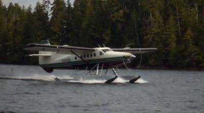
(Source: NTSB. Image from file. Not accident airplane)
 ANN's Daily Aero-Linx (04.13.24)

