The Flight Was For Pleasure And The Pilot Planned To Have Lunch In The Area Then Return To CMA Later In The Afternoon
Location: Los Angeles, CA Accident Number: WPR23FA172
Date & Time: April 29, 2023, 19:50 Local Registration: N575ND
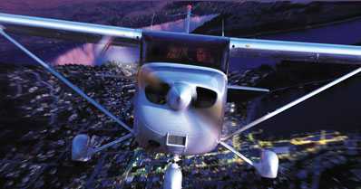
Aircraft: Cessna 172S Injuries: 1 Fatal
Flight Conducted Under: Part 91: General aviation - Personal
On April 29, about 1950 Pacific daylight time, a Cessna 172S, N575ND was substantially damaged when it was involved in an accident in Los Angeles, California. The private pilot was fatally injured. The airplane was operated as a Title 14 Code of Federal Regulations Part 91 personal flight.
The pilot was renting the airplane from a flight school at Camarillo Airport (CMA). He had approached the school in early April for a flight review, having last flown in July 2022 in the Bay Area of Northern California. The flight review was performed in both the accident airplane and an identically equipped model and was completed two days before the accident. For the outbound flight, the pilot departed CMA about 1340, and arrived at Bermuda Dunes Airport (UDD), Palms Springs about 1500. The airplane was serviced with the addition of 20 gallons of low-lead aviation gasoline shortly after arrival. According to friends, the flight was for pleasure and the pilot planned to have lunch in the area then return to CMA later in the afternoon.
Preliminary ADS-B data provided by the FAA indicated that for the accident flight, the airplane departed UDD at 1848, and flew on a northwest track reaching an altitude of about 7,000 ft mean sea level (msl) once reaching Banning Pass. The airplane then changed course to the west, where for the next 70 miles it flew through the Los Angeles Basin at an altitude of about 6,500 ft msl. Having reached the western edge of the Ontario Airport (ONT) Class C airspace (upper boundary 5,000ft), the airplane began a gradual descent, while maintaining separation from the northern edge of the Los Angeles International Airport (LAX) Class B airspace.
At 1943, the airplane had reached the southeastern edge of the Burbank Airport (BUR) Class C airspace (lower boundary 3,000 ft) at an altitude of 2,725 ft. The airplane continued to pass through and below a 1-mile-wide corridor between the LAX and BUR airspace. About 4 minutes later, having descended to about 2,000 ft msl, the pilot contacted the tower controller at Van Nuys Airport (VNY), and reported that he was 9 miles southeast, and had the most current weather observation.
Another airplane then made a radio transmission, and the pilot of the accident airplane responded that he could not clearly hear the transmission, and asked if it was intended for him. The VNY controller then responded and provided an instruction for the accident airplane to make left traffic for runway 16L. The pilot replied with the correct readback, and the controller provided him with a transponder code and stated that in the future, based on his approach to the airport, the pilot should contact BUR tower before contacting VNY.
The controller then asked for the aircraft type, and with no response from the pilot, he asked a second time, following which the pilot reported that it was a Cessna 172. The controller then provided the pilot with an instruction to turn right and fly direct to the I-405 and US 101 interchange. The pilot responded, “again sorry” and the controller replied with a suggested heading of 305°. The pilot responded and the airplane then began a descending right turn towards VNY. The controller asked the pilot to confirm he had the most current weather, and the pilot replied that he did. The pilot did not make any further transmissions, and for the final 60 seconds the airplane maintained the same heading, while descending to 1,375 ft. The VNY controller then transmitted that the airplane had dropped of his radar, and asked the pilot to confirm he was approaching the interchange. The pilot did not respond, and the controller continued with multiple transmissions to reach the pilot, all with no
response.
An alert notice (ALNOT) was issued after the airplane did not land at VNY, and the airplane wreckage was eventually located later that night, after a multi-agency search that was hindered by dense fog. The main wreckage was located an elevation of 1,345 ft msl, on a 45° south-facing slope, about 40 ft below the peak of a hill within a residential area in the Hollywood Hills, 6.5 miles South-Southeast of VNY.
The first identified point of impact was a level cut swath through a 5 ft wide bush, 100 ft west of the final ADS-B target. From there, a fresh ground scar continued on a heading of 285° to the main wreckage and contained fragments of the right wing tip, right main landing gear, right door and window, propeller and hub, and remnants of the instrument panel. The airplane came to rest nose-down on a heading of about 100° at the base of a tree, 150 ft west of the first impact point. The airframe sustained significant impact damage, crushing the firewall and forward cabin structure, and exposing the front left (pilot) seat. The right wing remained partially attached to the fuselage, and the left wing was detached and folded over the right wing. The tail section was upright and resting against the top of the tree.
Sunset occurred a 1937, with civil twilight ending at 2004. At 1951, VNY was reporting visual flight rules (VFR) weather conditions, including 10 miles visibility and clear skies. At the same time further towards the coast, Santa Monica Airport (SMO) was reporting low instrument flight rules (LIFR) conditions with 7 miles visibility and a 300 ft overcast ceiling. The planned destination airport, CMA, was reporting instrument flight rules conditions (IFR) with 8 miles visibility and a 600 ft overcast ceiling.
The pilot was issued his private pilot certificate in December 2020; he did not hold an instrument rating.
 Airborne 04.16.24: RV Update, Affordable Flying Expo, Diamond Lil

