Flights Check Rivers For Dam Failures, Other Issues
Civil Air Patrol is providing aerial reconnaissance as an
auxiliary of the U.S. Air Force as rivers and tributaries in North
Dakota and South Dakota continue to rise.
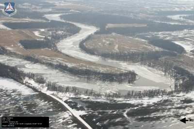
Red River Near Pembina, ND. Photo
Courtesy CAP
Current media reports indicate the Red River will crest this
weekend at 38 feet in the Fargo/Moorhead, MN, area. Members of
CAP's North Dakota and South Dakota Wings have assisted with
preparations for flooding in the two cities by helping fill more
than 1 million sandbags. "We knew ahead of time this mission was
coming our way, and we were ready for it," said Col. Steve Kuddes,
CAP's North Central Region commander. "I am proud of our
outstanding members in all of the affected wings. They took their
own time to prepare before these floods, and their work is
outstanding."
The mission has changed its focus from filling sandbags to
aerial surveys, said Kuddes. Thursday, the North Dakota Wing flew a
survey mission of Absaraka near Casselton to check reports that the
dam has failed.
On Wednesday North Dakota aircrews surveyed Beaver Creek from
the Missouri River to Linton, Spring Creek from Linton to the
northeast and the Heart River. They also surveyed the Cannonball
River to the Missouri River and Upper Heart River. The wing
conducted surveys Tuesday of the Missouri River from Bismarck to
Garrison Dam. It also surveyed Apple Creek from three miles north
of I-94 to the Missouri River and the Knife River from Marshall to
Hazen
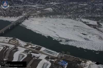
Missouri River Flows Through ND State
Capitol of Bismark. Photo Courtesy CAP
Aircraft and crews are assembling at the "Skunk Works" mission
base at Fargo's Hector International Airport. A plane from
Minnesota Wing equipped with CAP's ARCHER aerial imaging system
will survey the Red River from the South Dakota border to the
Canadian border for the Federal Emergency Management Agency and the
state of North Dakota.
Down the river in South Dakota, survey flights continue in
support of the South Dakota Office of Emergency Management.
Thursday, the wing flew survey missions of the rivers in the
eastern and western parts of the state. Areas of emphasis include
Watertown, Brookings, Aberdeen and Huron in the east. In the
western part of the state where flooding has not been as severe,
the focus is on capturing images around Moreau, Grand Forks and the
Cheyenne River to establish a baseline for potential damage
assessment if floods impact those areas.
Two air crews surveyed the James River north of Mitchell and the
Big Sioux River, Big Stone Lake, the Yankton River and an area
around Groton, S.D., on Wednesday. The wing surveyed flooding on
the James, Big Sioux and Vermillion Rivers on Tuesday. "The state
(of South Dakota) is greatly impressed by the photos they have
seen." said Col. Mike Beason, the mission's incident commander.
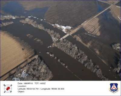
Photo Of Floodwaters Near Trent, SD.
Photo Courtesy CAP
Earlier this week, 75 members of the Minnesota and North Dakota
Wings assisted with sandbagging. They totaled more than 750 hours
of flood support and worked on protecting 30 homes in the
Fargo/Moorhead area. "Their support was very impressive," said Lt.
Col. Erik Ludlow, North Dakota Wing's ground operations
director.
Operations were scaled back Thursday as Fargo, Moorhead, Cass
and Clay counties reported their sandbag barriers are almost
complete. "We will be monitoring the situation throughout the
evening and tomorrow morning." said Ludlow.
 ANN's Daily Aero-Linx (04.15.24)

