Raytheon Delivers First UH-60L-Based LRIP To Army | Aero-News Network
Aero-News Network
RSS icon RSS feed
podcast icon MP3 podcast
Subscribe Aero-News e-mail Newsletter Subscribe

Airborne Unlimited -- Most Recent Daily Episodes

Episode Date

Airborne-Monday

Airborne-Tuesday

Airborne-Wednesday Airborne-Thursday

Airborne-Friday

Airborne On YouTube

Airborne-Unlimited-04.01.24

Airborne-Unlimited-04.16.24

Airborne-FlightTraining-04.17.24 Airborne-Unlimited-04.11.24

Airborne-Unlimited-04.12.24

Join Us At 0900ET, Friday, 4/10, for the LIVE Morning Brief.
Watch It LIVE at
www.airborne-live.net

Fri, Dec 17, 2004

Raytheon Delivers First UH-60L-Based LRIP To Army

Company Hopes To Eventually Put 120 Airborne C&C Helos In The AIr

Raytheon Company has delivered the first low rate initial production (LRIP) Army Airborne Command and Control System (A2C2S) to the US Army.

A2C2S prototypes have supported the Army's 4th Infantry Division (ID) in Iraq for more than a year and the 3rd ID since May 2004. During 17 months of combat duty, the A2C2S flying command posts logged thousands of mission hours to assist warfighters and peacekeepers overseas. Despite operating in the harshest combat environments, the command and control (C2) systems exceeded their performance and reliability requirements.

"With more than 3,000 operational hours-2,000 of them in combat-A2C2S is performing extremely well," said Brian McKeon, vice president of Raytheon Command and Control Systems.

The system's performance in combat confirmed its production readiness. As a result, Raytheon will manufacture five LRIP systems and two A-kits for EUH-60 helicopters. The company anticipates that additional A2C2S systems will be funded in fiscal year 2005; approximately 120 systems could be fielded to the Army during the program's lifetime.

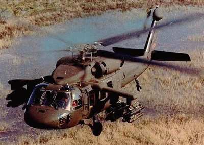
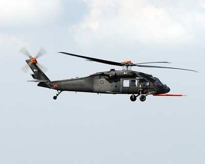
A2C2S equips selected Army UH-60L Blackhawk helicopters with a mission equipment package that transforms them into airborne command posts. The system enables commanders and their staffs-at brigade, division and above-to maintain digital command, control and communication while moving through the battlespace at 120 miles per hour. Called "C2 on-the-move," the new capability allows commanders to go wherever they are needed and maintain complete C2 capability.

The system supports digitized and non-digitized forces in all operational scenarios including large scale mechanized operations, smaller scale special operations and homeland defense applications. A parallel A2C2S effort called Homeland Defense Module links civilian emergency first responders to National Guard and active military forces that are involved in disaster response and homeland security missions. A proof of design demonstration phase began in November 2004. Raytheon expects the first prototype to be completed in 2005. Subsequent A2C2S systems will be integrated into platforms while they are on the Army's assembly line.

FMI: http://www.raytheon.com

Advertisement

More News

ANN's Daily Aero-Linx (04.15.24)

Aero Linx: International Flying Farmers IFF is a not-for-profit organization started in 1944 by farmers who were also private pilots. We have members all across the United States a>[...]

Classic Aero-TV: 'No Other Options' -- The Israeli Air Force's Danny Shapira

From 2017 (YouTube Version): Remembrances Of An Israeli Air Force Test Pilot Early in 2016, ANN contributor Maxine Scheer traveled to Israel, where she had the opportunity to sit d>[...]

Aero-News: Quote of the Day (04.15.24)

"We renegotiated what our debt restructuring is on a lot of our debts, mostly with the family. Those debts are going to be converted into equity..." Source: Excerpts from a short v>[...]

Airborne 04.16.24: RV Update, Affordable Flying Expo, Diamond Lil

Also: B-29 Superfortress Reunion, FAA Wants Controllers, Spirit Airlines Pulls Back, Gogo Galileo Van's Aircraft posted a short video recapping the goings-on around their reorganiz>[...]

ANN's Daily Aero-Term (04.16.24): Chart Supplement US

Chart Supplement US A flight information publication designed for use with appropriate IFR or VFR charts which contains data on all airports, seaplane bases, and heliports open to >[...]

blog comments powered by Disqus


Advertisement

Advertisement

Podcasts

Advertisement

© 2007 - 2024 Web Development & Design by Pauli Systems, LC