Mon, Jun 29, 2009
"Performing As Planned"
NASA and the National Oceanic and Atmospheric Administration
(NOAA) have received the first on-orbit signals from GOES-O,
indicating that the Earth-observation satellite is healthy and
operating normally. Controllers confirmed initial contact with the
spacecraft at 12:25 a.m. Eastern time at a ground station on the
Diego Garcia atoll in the Indian Ocean.
"We are very pleased to report that GOES-O is performing as
planned, and we will continue to support this satellite through
handover to NOAA so that it can fulfill its mission of providing
critical, life-saving weather information,” said Craig
Cooning, vice president and general manager of Boeing Space and
Intelligence Systems. "The launch of GOES-O is a testament to the
collaborative teaming and commitment of our employees to provide
best-of-industry, next-generation environmental systems to NASA and
NOAA."
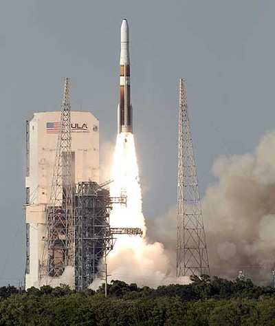
GOES-O was launched on a Delta IV rocket Saturday at 6:51 p.m.
Eastern time from Space Launch Complex 37B at Cape Canaveral Air
Force Station, Fla. Boeing commercial launch business Boeing Launch
Services procured the vehicle and mission services from United
Launch Alliance.
Sunday's signal acquisition marks the second successful launch
in the GOES N-P series and the latest step in enhancing
NOAA’s Earth-observation and weather-monitoring capabilities.
GOES-O, which is designed for a minimum orbit life of 10 years,
will be placed in on-orbit storage and may replace an older GOES
satellite in 2010. Together with GOES-13 (formerly GOES N), which
launched on May 24, 2006, GOES-O will provide complete coverage of
the Western Hemisphere.
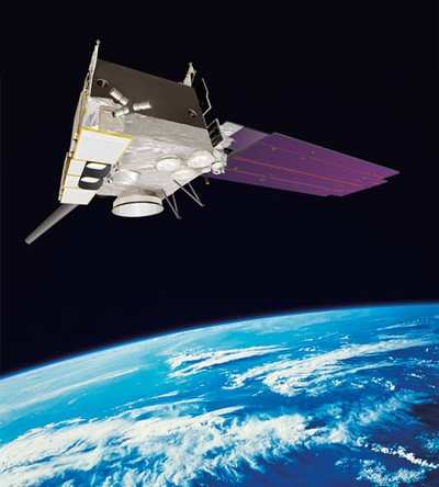
The three-axis Boeing 601 spacecraft includes an imager that
produces visible and infrared images of the Earth’s surface,
oceans, cloud cover and storm developments; a multispectral sounder
that provides vertical temperature and moisture profiles of the
atmosphere; and a solar X-ray imager that monitors the sun’s
X-rays for early detection of solar flares. GOES-O also carries
space environment monitoring instruments that will measure X-rays
and extreme ultraviolet and particle emissions, including solar
protons, alpha particles and electrons. The GOES-O communications
subsystem also includes a search-and-rescue capability to detect
distress signals from ships and airplanes.
More News
Aero Linx: International Flying Farmers IFF is a not-for-profit organization started in 1944 by farmers who were also private pilots. We have members all across the United States a>[...]
From 2017 (YouTube Version): Remembrances Of An Israeli Air Force Test Pilot Early in 2016, ANN contributor Maxine Scheer traveled to Israel, where she had the opportunity to sit d>[...]
"We renegotiated what our debt restructuring is on a lot of our debts, mostly with the family. Those debts are going to be converted into equity..." Source: Excerpts from a short v>[...]
Also: B-29 Superfortress Reunion, FAA Wants Controllers, Spirit Airlines Pulls Back, Gogo Galileo Van's Aircraft posted a short video recapping the goings-on around their reorganiz>[...]
Chart Supplement US A flight information publication designed for use with appropriate IFR or VFR charts which contains data on all airports, seaplane bases, and heliports open to >[...]
 ANN's Daily Aero-Linx (04.15.24)

