Thu, Aug 26, 2010
Sentient Launches Kestrel Maritime At AUVSI 2010
 The Australian computer vision technology company Sentient has
taken the wraps off a maritime surveillance system it says
automatically detects and tracks objects on the surface of the
ocean below an aerial vehicle.
The Australian computer vision technology company Sentient has
taken the wraps off a maritime surveillance system it says
automatically detects and tracks objects on the surface of the
ocean below an aerial vehicle.
Kestrel Maritime was introduced Wednesday at AUVSI 2010, an
unmanned systems exhibition taking place this week in Denver, CO.
The company says it is a computer vision solution for automated
EO/IR surveillance in the maritime environment which expands its
product range beyond the existing Land MTI solution currently
deployed in Afghanistan.
Sentient says the system assists ISR operators by processing and
exploiting EO/IR imagery in real-time, locating objects too small
for fatigued human eyes to detect. The solution complements radar
by detecting objects in littoral environments or objects with a low
electronic signature. “The maritime environment is very
challenging for aerial surveillance. The constantly changing
surface of the sea makes detection and tracking of small vessels
and objects very difficult for both humans and automated analysis
systems,” said Dr Paul Boxer, Managing Director of Sentient.
“In addition, radar has its own limitations in small object
detection as it is often unable to detect small boats or humans in
the water.”
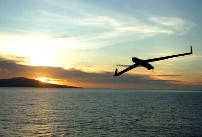
ScanEagle Over Water
Boxer says the system is capable of detecting small objects
through scattered clouds and in high sea states, despite whitecaps
and sun glare. “Kestrel Maritime’s ability to operate
in littoral environments and to find very small targets in
difficult conditions assist with counter narcotic operations close
to shore, passive submarine surveillance, illegal littoral
operations and search and rescue missions,” he said.
Kestrel Maritime has been successfully tested in a maritime
surveillance role on the P-3 Orion and Unmanned Aerial Vehicles
(UAVs) such as the Insitu ScanEagle. In one possible Concept of
Operations, Kestrel Maritime processes real-time imagery on board
the UAV, and thus enables multiple Small Unmanned Aerial Systems
(SUAS) to operate over the horizon (OTH).
“This application overcomes the bandwidth constraints for
SUAS operating over the horizon, giving manufacturers of smaller
UAS the ability to compete with alternative forms of Maritime
Patrol,” Boxer said.
More News
Aero Linx: International Flying Farmers IFF is a not-for-profit organization started in 1944 by farmers who were also private pilots. We have members all across the United States a>[...]
From 2017 (YouTube Version): Remembrances Of An Israeli Air Force Test Pilot Early in 2016, ANN contributor Maxine Scheer traveled to Israel, where she had the opportunity to sit d>[...]
"We renegotiated what our debt restructuring is on a lot of our debts, mostly with the family. Those debts are going to be converted into equity..." Source: Excerpts from a short v>[...]
Also: B-29 Superfortress Reunion, FAA Wants Controllers, Spirit Airlines Pulls Back, Gogo Galileo Van's Aircraft posted a short video recapping the goings-on around their reorganiz>[...]
Chart Supplement US A flight information publication designed for use with appropriate IFR or VFR charts which contains data on all airports, seaplane bases, and heliports open to >[...]
 ANN's Daily Aero-Linx (04.15.24)

