Aircraft Was Never Recovered From The Water
The NTSB has released its probable cause report from an accident which occurred in December, 2016 in which a Cessna 172 went down in the water near Molokai Airport (PHMK), Kaunakakai, Hawaii, but the board could not determine the probable cause of the accident because the aircraft was not recovered from the water.

According to the report, the airplane, a Cessna 172M, N174LL, impacted water near Molokai Airport (PHMK), Kaunakakai, Hawaii en route to the Honolulu Airport (HNL), Honolulu, Hawaii. Since that time, the private pilot and two passengers have not been located, and the airplane is missing. The airplane disappeared from Air Traffic Control radar after takeoff and is presumed to have crashed in the Pacific Ocean. The airplane was registered to Yamataka Kumiko and operated by Lani Lea Sky Tours, LLC under the provisions of 14 Code of Federal Regulations Part 91 as a personal flight. Visual meteorological conditions prevailed, and a visual flight rules flight plan was filed for the cross-country flight that departed PHMK at 1843.
A representative of the airplane rental facility reported that the pilot had rented one of their airplanes and departed HNL a few hours earlier on a recreational flight to PHMK. At the time of the accident, the flight was returning to HNL. According to Federal Aviation Administration (FAA) ATC radar data, shortly after the airplane's departure from PHMK it immediately started a shallow climb to the northwest. At 1848:28, the airplane began a descending right turn from a Mode C reported altitude of approximately 2,525 feet msl. The radar track ended at 1849:04, over open water approximately 1.5 nautical miles (nm) from the coast and about 7 nm northwest of PHMK.
On December 30, at 1913, the FAA issued an alert notice (ALNOT) for the missing airplane after FAA Air Traffic Control (ATC) lost radar contact with the airplane.
A search and rescue effort, conducted by the United States Coast Guard, began immediately after the missing airplane report was issued, but was subsequently suspended on January 2, 2017. To date, the missing airplane has not been located, and no emergency locator transmitter (ELT) signal was received during the search and rescue activities. Additionally, attempts to locate a signal from the pilot's cell phone utilizing network-based location analysis were unsuccessful.
The pilot, age 26, held a private pilot certificate with a rating for airplane single-engine land, which was issued on October 30, 2016. His most recent first-class medical certificate was issued on March 5, 2014, at which time he reported 1 total hour of flight experience. The pilot's FAA application for airman certificate indicated that he had accumulated a total of 73 flight hours, 4 instrument hours, and 14 hours of which were under the category "Night TakeOff/Landing." His personal flight logbook was not recovered.
According to the final report, flightpath data provided by the Federal Aviation Administration (FAA) indicated that, shortly after departure, the airplane flew to the northwest, directly into the area that was showing adverse weather conditions. Sometime later, radar data showed that the airplane began a descending right turn from about 2,525 ft mean sea level. The track ended less than 1 minute later over open water about 7 miles northwest of the departure airport. An alert notice was issued after an FAA air traffic control facility lost radar contact with the airplane. A search and rescue effort was initiated; however, the airplane and occupants were not found.
The NTSB determined that the probable cause(s) of this accident to be "Undetermined because the airplane was not located."
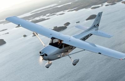
(Image from file. Not accident airplane)
 ANN's Daily Aero-Term (04.20.24): Light Gun
 Aero-News: Quote of the Day (04.20.24)
 ANN's Daily Aero-Linx (04.21.24)
 Aero-News: Quote of the Day (04.21.24)
 ANN's Daily Aero-Term (04.21.24): Aircraft Conflict


