Aero-Tips!
A good pilot is always learning -- how many times have you heard
this old standard throughout your flying career? There is no truer
statement in all of flying (well, with the possible exception of
"there are no old, bold pilots.")

Aero-News has called upon the expertise of Thomas P. Turner,
master CFI and all-around-good-guy, to bring our readers -- and us
-- daily tips to improve our skills as aviators. Some of them, you
may have heard before... but for each of us, there will also be
something we might never have considered before, or something that
didn't "stick" the way it should have the first time we memorized
it for the practical test.
Look for our daily Aero-Tips segments, coming each day to you
through the Aero-News Network.
Aero-Tips 08.22.06
I spent last weekend training a Baron owner in Nashville. Sunday
morning we practiced a few instrument approaches in near-IMC
conditions; two huge complexes of heavy rain and thunderstorms were
just north of the Kentucky line, about 40 miles away -- we were
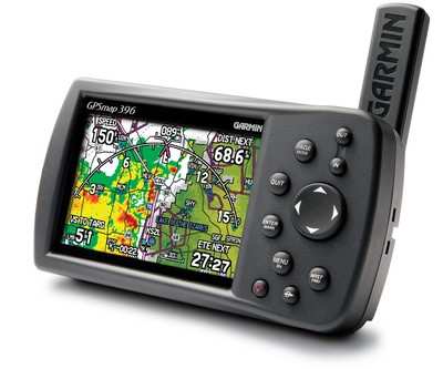
watching the developing system closely on a Garmin 396 NEXRAD
display perched on the Baron's glareshield.
We were on an IFR clearance in the darkening haze, so we were
listening to other airplanes as they dealt with the blossoming
storms. Airliners were deviating as they climbed north out of
Nashville. A turboprop pilot amended his flight plan to Toledo,
Ohio, to go west across the Mississippi River before turning north
behind the front. And then the pilot of a Piper Cherokee checked in
on frequency (I'm reconstructing the exchange from memory):
 "'Morning Nashville, Cherokee
12345 (not his real registration) at 5000 feet."
"'Morning Nashville, Cherokee
12345 (not his real registration) at 5000 feet."
"Good morning 345, Nashville altimeter 29.99."
"And Nashville, 345, what are you showing as the weather
between here and Louisville [Kentucky]?"
"345, there's an area of moderate to extreme radar returns
at your 12 o'clock and 15 to 30 miles. Do you have on-board
weather?"
Observations: When Air Traffic Control (ATC)
uses the word "extreme" to describe weather, it's time to go
somewhere else. And if they ask if you have "on-board weather"
they're really saying "you need to be able to see the nasty stuff
going on around you."
"Yeah, we were lookin' at the yellow and red on my [Garmin]
396 and just wondered if you saw it too."
"345, everyone's been deviating around that, going as far
west as Cape Girardeau [Missouri] before heading north."
Meanwhile the Cherokee is still headed toward the storm complex
at two miles a minute. The thick haze is looking very black to the
northeast as my student flies vectors for an ILS approach. I
remember saying "come on, Cherokee, turn around and land" out loud
as my student was following the exchange even as he flew.
"345, this is Nashville, what are your intentions?"
"345 is still going to Louisville."
"Roger 345, if that's what you want to do. You now have an
area of extreme precipitation at your 12 o'clock and five
miles."
Observation: If ATC says "if that's what you
want to do," chances are that's not what you want to do.
The controller paused to give us a vector to intercept the
localizer. As my student expertly glided through a right turn
toward the airport -- away from the weather -- the Piper's silence
was frightening. I could only imagine what it was like in the
Cherokee. And then,
"Nashville, Cherokee 345 wants to divert to the nearest
airport."
ATC complied, and the Piper was vectored south to a nearby
airport. Since he's not on this morning's preliminary accident
reports it seems he made it down all right.
What might have been influencing the Piper pilot's decision?
Might it have been a feeling that ATC would vector him around the
weather? The pilot saw it on his NEXRAD download, but he felt
compelled to ask the controller if he saw it too, as if to say
"aren't you going to change my route to go around this stuff?" And
even then the pilot pressed onward, like he was waiting for ATC to
change his route for him.
Controllers don't have the authority to make you change your
route or altitude to avoid dangerous weather. Their job is to keep
you from running into other IFR airplanes. Anything else is just
advisory... and you are pilot-in-command.
Aero-tip of the day: Work with ATC for strategy
around weather, but don't wait for anyone else to make weather
decisions for you... because they won't.
 ANN's Daily Aero-Linx (04.13.24)

